Edgehill Circular
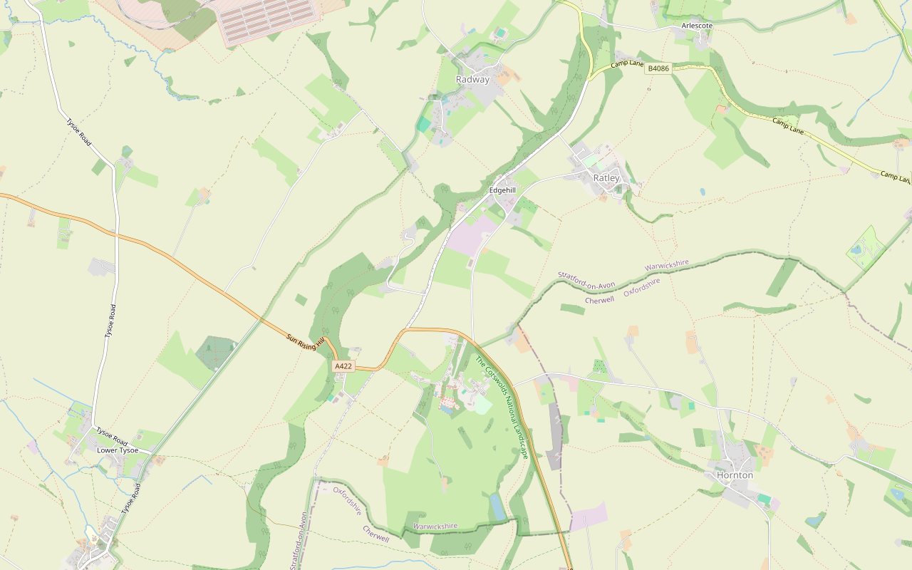
The Edgehill Circular is a 5.4-mile (8.6km) moderate circular walk from the Upton House car park, about two and a half hours with 220m of climbing. It follows the Edge Hill ridge to the Castle pub, returns through Ratley, and has six stiles and 500m on the A422.
- Distance
- 8.6 km (5.3 mi)
- Difficulty
- Moderate
- Time
- 2 hrs, 30 mins
- Ascent
- 220 m
- Circular
- Circular
The route
Starts at National Trust car park at Upton House, off the A422 (OX15 6HT) follows the Macmillan Way for a while Steep sectionStilesMuddy in winterDogs on lead near sheep Download GPX
Step by step
-
Step 1: Upton House to Sun Rising Hill
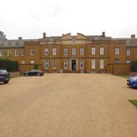
From the Upton House car park, go through the kissing gate and take the public footpath south-west, with Upton Farm's buildings to your left. OpenStreetMap maps two more gates in the next 500m, and the National Trust's trail sheet mentions a stile in the hedge beyond them. Keep to the line across the fields for about 1.4km to Sugarswell Lane.
Cross the lane and go through the gate by the wood. The track on the far side is not a public right of way: the Trust says it is open to walkers by permission of the Upton Estate. At its end, go through to the top of the scarp at Sun Rising Hill, where OpenStreetMap marks a viewpoint.
Turn right along bridleway SS26c on the edge of the hill. It runs through woodland past paddocks and stables to a farm. Follow the short concrete lane from the farm to the A422.
-
Step 2: Along the ridge to the Castle
Turn left along the A422 for about 60m, with no pavement and a 60mph limit, then cross with great care to footpath SS24 on the far side.
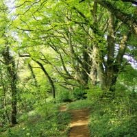
Follow SS24 north-east along the ridge for about 1.6km, with the Macmillan Way and the Centenary Way. A mapper describes tree roots and vegetation on this path, and it is narrow in places. Cross a small lane halfway. At King John's Lane, a bridleway, keep ahead on footpath SM170d, climb a short flight of steps and carry on through the trees to a kissing gate. The Castle at Edgehill is just beyond it, about 2.8 miles from the start.
- Muddy in winter
-
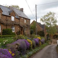
Step 3: Down and up Jacob's Ladder to Ratley
From the Castle, stay on SM170d along the ridge for 200m, then follow bridleway SM171 north-east as it drops through the wood for about 300m. Go through the kissing gate and turn right onto footpath SM172. This is the steep part: steps and then a path that OpenStreetMap names Jacob's Ladder, climbing about 40m in 150m.
At the top, cross the road and take Old Road south-east into Ratley, which becomes High Street. Follow it through the village for about 600m in all.
- Steep section
-
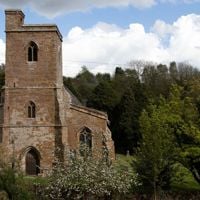
Step 4: Ratley to Quarry Road
At the south end of High Street, take the gravel track on the right, then the footway beyond it. OpenStreetMap maps stepover stiles at about 60m, 200m and 450m along here, and the motte and bailey lies just off the path. Cross the track that mappers call Llama Lane.
Keep south on the grass path for about 1.4km, through a swing gate and a kissing gate to Uplands Farm, with two more stepover stiles either side of the farmyard. Mappers note overgrown vegetation here, with the path as narrow as 35cm in one place. Past the old quarry and Hope Farm, join Quarry Road and turn right for 300m.
- Stiles
- Muddy in winter
-
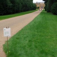
Step 5: The A422 back to Upton House
At the A422, turn right. This is the stretch to take seriously: about 500m on a 60mph road with no pavement. OpenStreetMap records grass verges on both sides that you can walk on, so stay on the verge and face oncoming traffic where you can.
Near the entrance to Upton House, leave the road on the woodchip path, cross the drive, then cross the A422 with care to the footpath and the drive into the car park.
Sights on the way
The sights this walk passes, numbered as on the map.
-
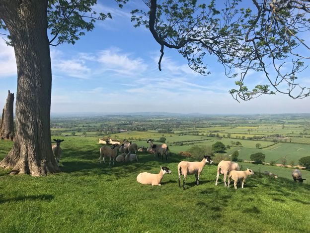
Edge Hill viewpoint
Sight · Viewpoint · Edgehill and Radway
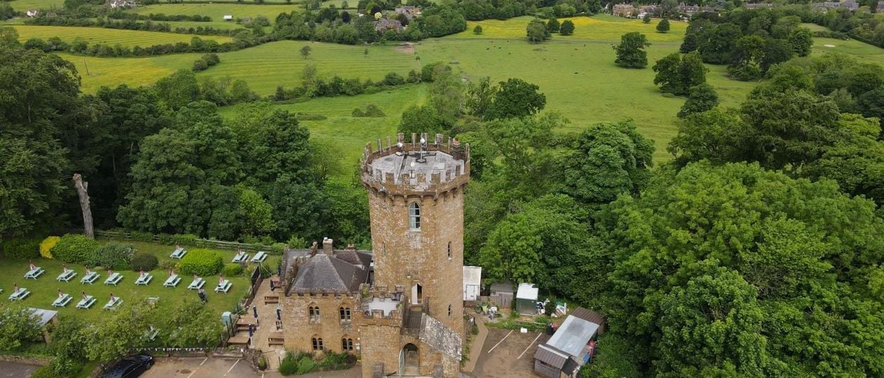
The long view from the top of Edge Hill, north-west of Banbury, across the plain where the Battle of Edgehill was fought in 1642. There is no signed viewpoint: the ridge road, the footpaths and the garden of a 1740s sham castle are how you see it.
-
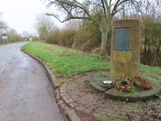
Edgehill battlefield
Sight · Monument · Edgehill and Radway
The first pitched battle of the English Civil War was fought below Edge Hill on 23 October 1642. Most of the field is now closed Ministry of Defence land, so you see it from the ridge and from a roadside memorial stone. Registered by Historic England.
The walk in detail
The Edgehill Circular is a 5.4-mile (8.6km) circular walk from the National Trust car park at Upton House. It takes about two and a half hours and climbs about 220m, so we rate it moderate. Halfway round is the Castle at Edgehill, the sham castle pub above the 1642 battlefield.
It is a ridge walk with a sting. There are six stiles, two flights of steps and one steep climb, and it ends with about 500m on the verge of the A422. Nobody from this guide has walked it yet: the directions come from the route line and OpenStreetMap, and a walk-through is pending.
What you see from the Edge Hill ridge
The ridge is the reason to do this walk, and you get about 3km of it, from Sun Rising Hill to the Castle. The National Trust puts the edge at 215m above sea level and calls it the most north-easterly outcrop of the Cotswolds, with views across north Warwickshire. Our Edge Hill viewpoint page explains what you are looking at. There is no signed viewing point, and much of the ridge path runs through trees, so take the views where the wood opens.
The Macmillan Way and the Centenary Way share the path for most of this stretch, according to OpenStreetMap, so you may see their waymarks. Sun Rising Hill is where the A422 climbs the scarp, and the first short road crossing is near the top of it.
The Castle at Edgehill and the battlefield
The Castle at Edgehill is the natural stop, about 2.8 miles (4.6km) in, and the only pub actually on the line. Sanderson Miller built the octagonal tower in about 1746 to 1747. It is said to stand where Charles I raised his standard, and we know of no record that fixes the spot. Today it serves Hook Norton ales and food. On weekdays the kitchen shuts between 2.30pm and 5pm, so time your start if you want a hot lunch. Its website does not say whether dogs may come inside, so ask.
The Battle of Edgehill was fought on the plain below on 23 October 1642. Most of the field is now closed Ministry of Defence land, and the walk does not go down to it: the ridge is where you can make sense of it. Our story of the Civil War in Banburyshire has the wider campaign, and the haunted battlefield separates the pamphlet from the legend.
Ratley and its stone
Ratley is the ironstone village on the second half of the walk, and it has two things worth a short detour. St Peter ad Vincula, about 100m off the line, is listed Grade II*, with a twelfth-century chancel and a thirteenth-century nave and tower. The earthworks of a motte and bailey castle, a scheduled monument, lie close to the path south-west of the village.
The Rose & Crown, just off the line in the village, closed in December 2024 and reopened on 1 October 2026 under new management, CAMRA says. When we checked in November 2026 its own website gave food from noon to 2pm and 5pm to 8pm Wednesday to Saturday, noon to 3pm on Sunday and noon to 2pm on Monday, with the pub closed on Tuesdays. CAMRA's entry says well-behaved dogs on leads are welcome. The rust-gold walls are Hornton stone, quarried on this ridge for centuries, and our story on the stone tells how. OpenStreetMap still marks the old quarries at Edgehill, and the line of the short-lived Edge Hill Light Railway beside Old Road.

The Banburyshire newsletter
Events, new places and the best of the season, about once a month. Unsubscribe at any time.
What walkers should know before setting out
The A422 is the main thing, as of November 2026. About 500m on the way home is on the road itself, with a 60mph limit and no pavement. The National Trust tells walkers on its own shorter walk from Upton to take great care on the A422 because there is no footway, and to follow the verge. We found no report of an accident or closure on this line, but we would not bring small children or a dog that pulls.
The rest is ordinary farmland walking. The Trust warns that parts are slippery in wet weather, especially along the ridge, and that animals may be grazing. OpenStreetMap's mappers note narrow, rooty paths on the ridge and overgrown vegetation south of Ratley, so long trousers are sensible in summer. We have found no reports of closed paths on the route. Warwickshire County Council takes reports of problems on its rights of way on 01926 413427.
Parking and getting there
Park at Upton House, and check the hours first, because this decides your day. The Trust says the car park is only open during the house and garden's usual hours and is locked outside them, and those hours change through the year: on 12 November 2026, for example, the Trust gave the garden as open 11am to 4pm. Allow at least three hours with a stop. A ticket for the gardens is separate: if you want them as well, see our Upton House guide for prices.
Stagecoach's 76A calls at Upton House once each way, Monday to Saturday: it leaves Banbury bus station (Bay 8) at 10.35am and reaches the house at 11.05am, and the return passes Upton House at 3.01pm, reaching Banbury at 3.30pm (timetable data for November 2026). That leaves time for the walk and a stop. There is no Sunday bus. Our buses guide has the services around Banbury, and Banbury station is the nearest railway; the National Trust puts it about 8.5 miles away. To stay nearby, the Castle has five rooms.
Other walks nearby
For more of this country, the Broughton and Wroxton circular is a shorter loop between two estates closer to Banbury, and the Banbury Ironstone Heritage Walk is the long one, from the town out to Wroxton and back. Adderbury and Bloxham Grove is the short option south of the town.
Places on the way
-
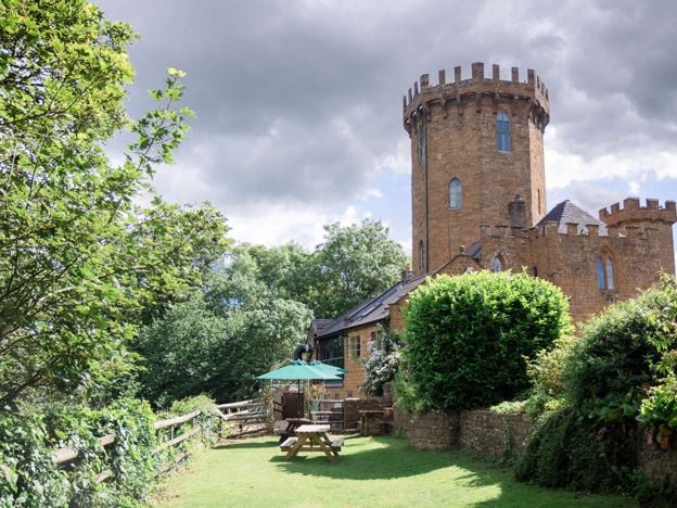
The Castle at Edgehill
Pubs · Edgehill and Radway
A pub and restaurant in the castellated 18th-century tower on top of Edgehill, above the 1642 battlefield, with Hook Norton ales, large gardens, five en-suite rooms and a gin school in the tower.
Family-friendly · Wedding venues
Verified Nov 2026
-
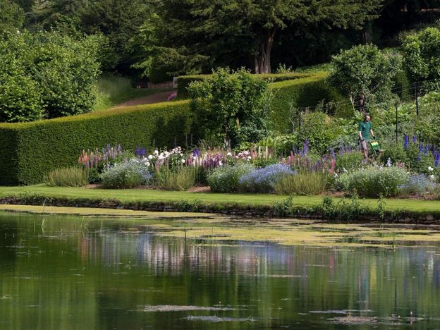
Upton House and Gardens
Historic houses and heritage
A National Trust house on the Edge Hill ridge, remodelled in the 1920s for the oil magnate Lord Bearsted to show his paintings by Bosch, El Greco, Stubbs and Hogarth, above terraced gardens that drop 30m to a Mirror Pool.
Family-friendly · Dog-friendly · Rainy days
Verified Nov 2026
Stay near the start
Inns, cottages and hotels within a short drive of where the walk begins, so you can set off early.
Where to stay in Edgehill and Radway-
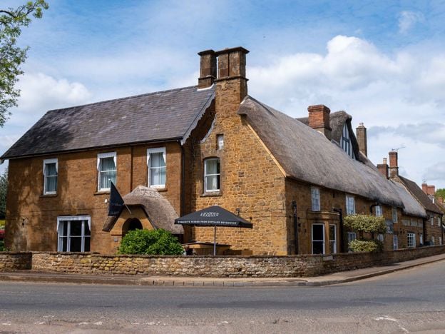
The Wroxton Hotel
Hotel · Wroxton
A 32-room hotel made from three adjoining stone cottages, partly dating from 1649, on the edge of thatched Wroxton, a few minutes' drive from junction 11 of the M40, with free parking and its own tea room.
Dog-friendly · Wedding venues
Verified Nov 2026
More like this
Stories on this walk
-
Walks near Banbury
Story · Guides · 8 minute read
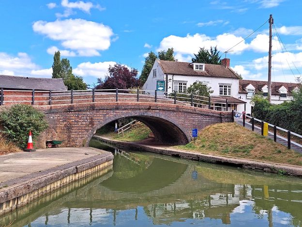
Walks near Banbury: the towpath to Cropredy, the Ironstone Heritage Walk from the station, short circles round Wroxton and Adderbury, the Edgehill ridge, Badby's bluebell wood and the parish walks at Great Tew, Hook Norton and Kings Sutton, with distances, stiles and parking.
More walks to try
-
Banbury Ironstone Heritage Walk
Walk · Starts in Banbury · 4 hrs · Circular
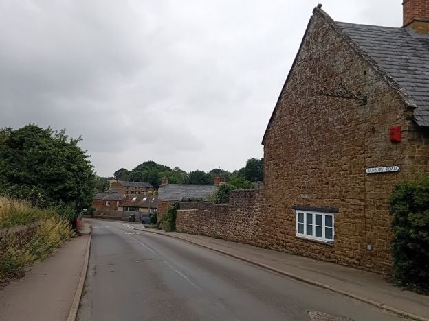
The Banbury Ironstone Heritage Walk is a 9.6-mile (15.5km) moderate circular walk from Banbury station, about four hours with 180m of climbing. It follows the canal, skirts the northern estates, reaches Wroxton and North Newington, and ends at Banbury Cross.
-
Broughton Road to Wroxton Obelisk Circular
Walk · Starts in Broughton · 2 hrs · Circular
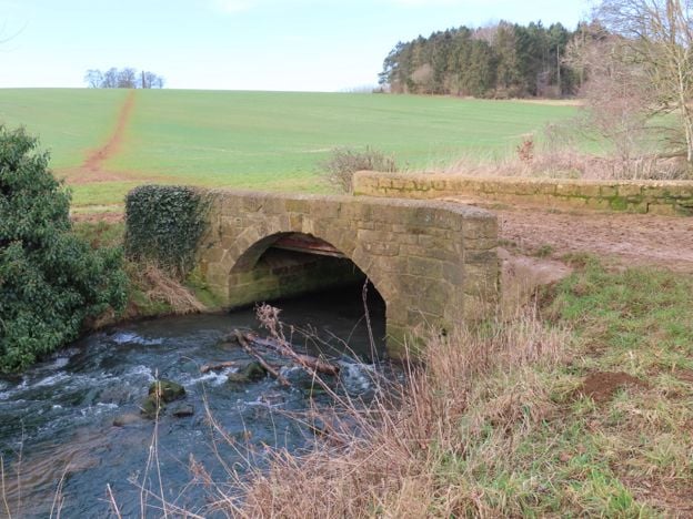
A 4.5-mile (7.3km) circular walk from the car park on Broughton Road, about two hours of moderate walking on field paths. It crosses the Sor Brook, climbs to the Wroxton Obelisk and returns by the other bank. It does not go through Broughton or past the castle.
-
North Newington and Wroxton Circular
Walk · Starts in North Newington · 2 hrs · Circular
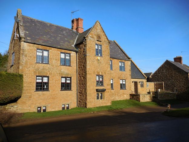
A 3.3-mile (5.3km) circular walk from Main Street, North Newington, taking about two hours of moderate walking. It follows field paths to the Sor Brook, climbs past the Wroxton Obelisk into Wroxton and returns over the fields.