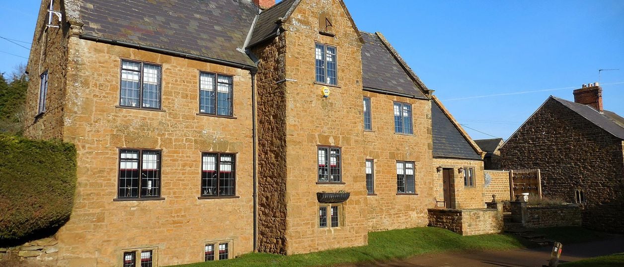
Ian Rob, CC BY-SA 2.0, via Wikimedia Commons
North Newington and Wroxton Circular
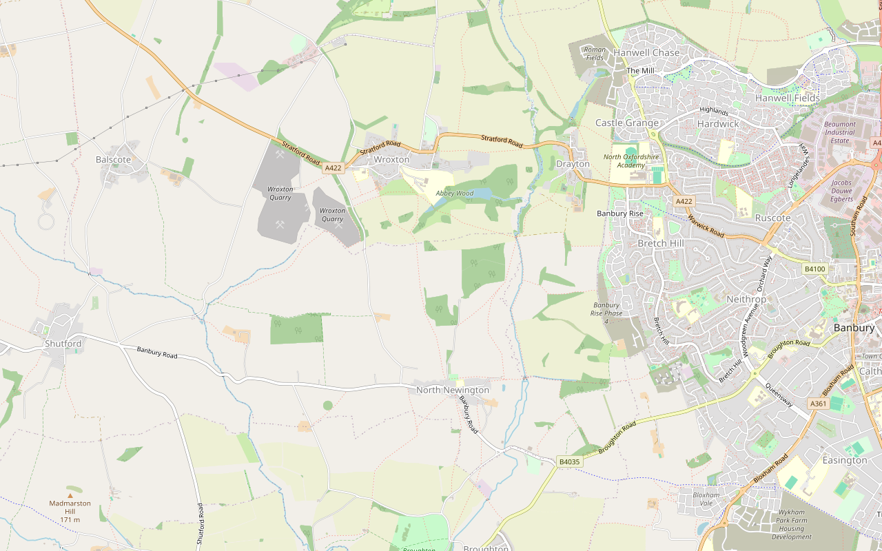
A 3.3-mile (5.3km) circular walk from Main Street, North Newington, taking about two hours of moderate walking. It follows field paths to the Sor Brook, climbs past the Wroxton Obelisk into Wroxton and returns over the fields.
- Distance
- 5.3 km (3.3 mi)
- Difficulty
- Moderate
- Time
- 2 hrs
- Ascent
- 95 m
- Circular
- Circular
The route
Starts at Main Street, North Newington Muddy in winterStilesLivestock in fields Download GPX
Step by step
-
Step 1: North from Main Street to the Sor Brook
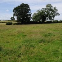
From Main Street in North Newington, take the lane heading north out of the village. Where it ends, about 600m on, keep ahead on the footpath that runs north-east across the fields, dropping into the valley of the Sor Brook. Follow it with the brook close by on your right until you reach a footbridge.
- Muddy in winter
- Stiles
-
Step 2: Past the bridge and up to the obelisk
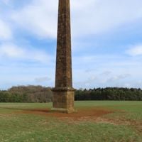
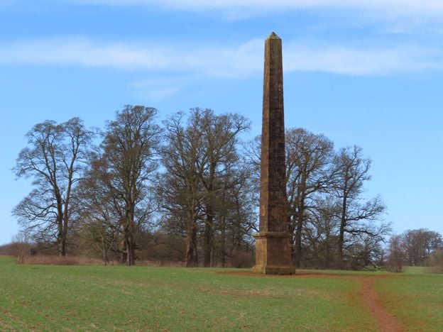
Do not cross the bridge. Turn left and take the public footpath west, uphill and away from the brook. It runs straight for the Wroxton Obelisk, which stands beside the path in a farmed field, about 500m from the bridge. Stay on the path.
-
Step 3: Through the park to Wroxton's pond
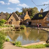
Carry on north-west along the public footpath. It passes through a kissing gate and crosses the Abbey's park, with the dovecote about 65m away on your left, and the Abbey itself off to the right. Stay on the footpath all the way to Dark Lane, then follow the lane to the junction with Main Street by the duck pond.
-
Step 4: Through the village and back over the fields
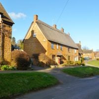
Turn left along Main Street, heading west past the cottages, for about 300m. Just past the turning for Wroxton Court, take the footpath on the left, which runs south out of the village. Keep south where it crosses another path, then follow it south-east and south across the fields for about 1.8km, until it meets the lane you walked out on. Follow the lane south to Main Street.
- Muddy in winter
- Stiles
Sights on the way
The sights this walk passes, numbered as on the map.
-
Wroxton Obelisk
Sight · Monument · Wroxton
A tall ironstone obelisk in the fields south-east of Wroxton Abbey, west of Banbury, marking a visit by Frederick, Prince of Wales, in 1739. Part of the eighteenth-century landscape, and Grade II*. On farmland, beside a public footpath.
-
Wroxton Dovecote
Sight · Historic building · Wroxton
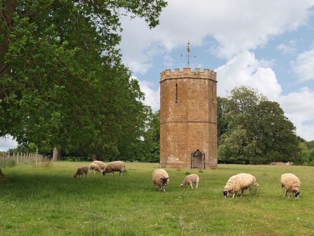
A Gothic dovecote of 1745 by Sanderson Miller in the park of Wroxton Abbey, west of Banbury, built both to house pigeons and to look like a small castle from the house. Ironstone, polygonal and Grade II*. In the Abbey's park, so seen from a distance.
-
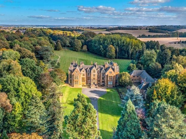
Wroxton Abbey
Sight · Historic building · Wroxton
A Jacobean house of about 1618 west of Banbury, on the site of a medieval priory and long the home of the Norths. Grade I. It is a college and closed to visitors. It passed to an alumni-led group in 2025 to 2026, and a public footpath crosses the grounds.
-
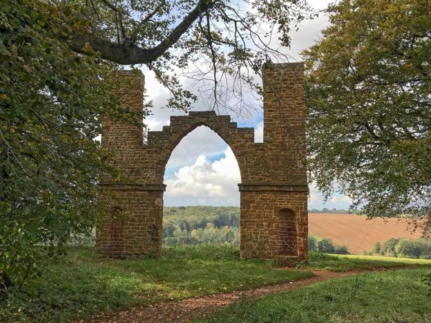
Drayton Arch
Sight · Historic building
A ruined Gothic arch between two thin turrets, built about 1750 as a sham ruin to Sanderson Miller's design for the Wroxton Abbey estate. Grade II*, in fields near Drayton, and reached by a public footpath from Wroxton.
The walk in detail
The North Newington and Wroxton Circular is a 3.3-mile (5.3km) loop from Main Street in North Newington to Wroxton and back. It is moderate, with about 95m of climbing, and takes about two hours. It passes the Sor Brook, the Wroxton Obelisk and Wroxton's duck pond, on field paths and village streets.
Allow for mud by the brook and for stiles. The Abbey is closed to visitors, so this is a walk past it and not a visit. We have not walked this line ourselves yet: it is drawn along mapped paths, so read the section on the route before you go.
What you pass on the way
The walk's two best sights are eighteenth-century follies on the Wroxton Abbey estate. The Wroxton Obelisk, Grade II*, carries an inscription marking the visit of Frederick, Prince of Wales, for the Banbury races of 1739. The Victoria County History says it was put up to commemorate the visit, and Historic England dates it to about 1750, probably by Sanderson Miller, so the date is unsettled.
The Wroxton Dovecote is a small Gothic tower of ironstone by Sanderson Miller, of 1745, built both to house pigeons and to be looked at across the park. It is listed Grade II*, and you see it from the path, not close up: we could not confirm a public path right up to it. From the bridge over the brook, look east along the skyline for Drayton Arch, a folly and eyecatcher of about 1750 by Sanderson Miller, part of the same landscape.
Wroxton Abbey and its grounds
The line keeps to the public footpath across the grounds of Wroxton Abbey, a Jacobean house of about 1618 that is now a college. The house is closed to visitors. Wroxton's village website says the grounds remain accessible for walks, and the college publishes nothing on it (November 2026). The Abbey has its own page, which sets out what is and is not established.
Wroxton's village website also says dogs are not permitted in the Abbey's grounds. We have not confirmed how that applies on the public footpath, so ask if you are bringing a dog.
Wroxton's pond and street
The duck pond sits below the church at the bottom of Wroxton's street, and the walk turns west there along Main Street. The Victoria County History describes the cottages as mostly two-storey, of coursed ironstone, and of the early seventeenth or eighteenth century, with much thatch still in 1965. All Saints, whose tower Sanderson Miller designed in 1748, is a short walk up the street from the pond and off the line.
North Newington
North Newington is a small ironstone village strung along Main Street and Park Lane. Fourteen of its buildings and structures are listed, all Grade II, including two old village pumps. Our guide to North Newington has the rest. It has no sights to speak of, so treat it as the start and finish of the walk, not a stop of its own.

The Banburyshire newsletter
Events, new places and the best of the season, about once a month. Unsubscribe at any time.
The route and what walkers report
This route is drawn, not recorded on the ground. We drew it along paths mapped in OpenStreetMap, through the places named in the walk's old text, and checked it against Oxfordshire County Council's rights of way layer of February 2026. Most of the line follows paths recorded there, including the stretch across the Abbey's grounds, though the council says its layer is only a guide to the legal line. Walk-through by our team is still to come, so take an OS map (Explorer 206 covers the area). Oxfordshire County Council has a temporary diversion on part of Wroxton and Balscote Footpath No.3 until 31 December 2026, without saying which part, so follow any signs on the Wroxton paths.
A Ramblers group described its own walk from Wroxton over some of these paths in February 2025 as undulating, with four stiles. We have not counted the stiles on this line. A walking group's account of a walk round Wroxton in April 2015 mentions open views, spring flowers and glimpses of Drayton Arch on the skyline. The ground by the brook can be muddy in wet months, so wear waterproof boots, and the fields may hold livestock.
Food, parking and getting there
Both of Wroxton's pubs have shut. In North Newington, the Blinking Owl on Main Street has no website or published hours, so ring 01295 730650 before you count on it, and otherwise bring what you need. By car, the nearest meals we have checked are the Wroxton Hotel, whose restaurant is open to non-residents for dinner seven days a week, and the Roebuck Inn at Drayton, which is closed on Mondays and Tuesdays.
We found no public car park in North Newington, so park on Main Street with care, keeping clear of gates and the narrow stretches. We could not confirm a regular bus to North Newington. Stagecoach's 76 and 76A from Banbury stop on the A422 at Wroxton, at The Firs and Horley Turn, with five buses out of Banbury and four back, Monday to Saturday, and none on Sundays (November 2026), so you can start this walk from Wroxton's Main Street instead. Broughton Castle is about 2 miles from Wroxton if you want a house to go inside.
A longer way round
For a longer walk over the same ground, the Drayton, Wroxton and North Newington Circular adds Drayton Arch from the edge of Banbury.
Places on the way
-
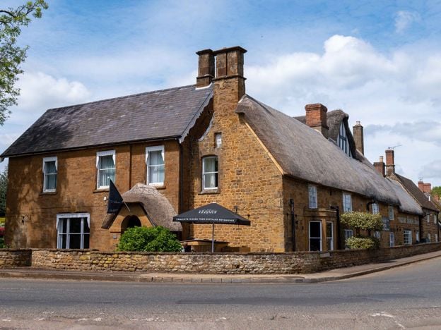
The Wroxton Hotel
Hotel · Wroxton
A 32-room hotel made from three adjoining stone cottages, partly dating from 1649, on the edge of thatched Wroxton, a few minutes' drive from junction 11 of the M40, with free parking and its own tea room.
Dog-friendly · Wedding venues
Verified Nov 2026
-
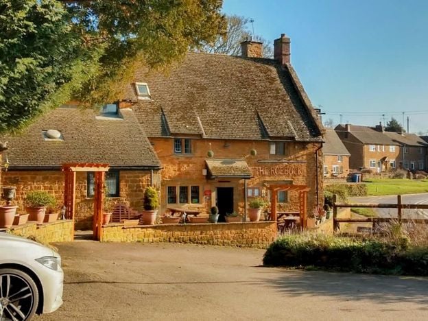
The Roebuck Inn, Drayton
Pubs
A Hook Norton pub in a late 17th-century listed building on the A422 at Drayton, just outside Banbury, with a south-facing courtyard, a modern British menu, a car park and dogs welcome.
Dog-friendly
Verified Nov 2026
Stay near the start
Inns, cottages and hotels within a short drive of where the walk begins, so you can set off early.
Where to stay in North Newington-
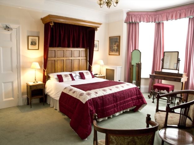
Banbury Cross Bed and Breakfast
B&B · Banbury
A family-run Victorian B&B on Broughton Road, Banbury, with seven bedrooms, about 370m from Banbury Cross, with free off-road parking, cooked breakfasts and rates from £77. No under-18s.
Car-free
Verified Nov 2026
-
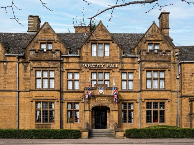
Whately Hall Hotel, Banbury
Hotel · Banbury
A Grade II listed 17th-century inn, now a 71-room hotel on Horse Fair in the middle of Banbury, with gardens, an oak-panelled restaurant and six EV chargers.
Dog-friendly · Family-friendly · Wedding venues
Verified Nov 2026
-
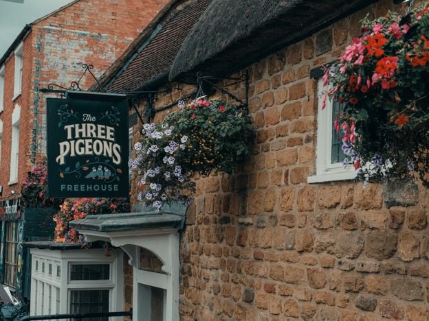
The Three Pigeons, Banbury
Pubs · Banbury
A Grade II listed 17th-century inn, partly thatched, on Southam Road, Banbury, with real ales and ciders, a courtyard, Smash Cow street food from Thursday to Saturday and three en-suite rooms.
Dog-friendly · Car-free
Verified Nov 2026
More like this
More walks to try
-
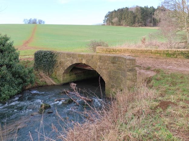
Broughton Road to Wroxton Obelisk Circular
Walk · Starts in Broughton · 2 hrs · Circular
A 4.5-mile (7.3km) circular walk from the car park on Broughton Road, about two hours of moderate walking on field paths. It crosses the Sor Brook, climbs to the Wroxton Obelisk and returns by the other bank. It does not go through Broughton or past the castle.
-
Banbury Fringe Circular Walk
Walk · Starts in Banbury · 5 hrs · Circular
A 10.6-mile (17.1km) waymarked circular walk round the edge of Banbury, moderate and about five hours: the Oxford Canal south to Bodicote, the Salt Way past Crouch Hill, field and wood paths by Giant's Cave, and an old ironstone railway back to the canal.
-
Banbury Ironstone Heritage Walk
Walk · Starts in Banbury · 4 hrs · Circular
The Banbury Ironstone Heritage Walk is a 9.6-mile (15.5km) moderate circular walk from Banbury station, about four hours with 180m of climbing. It follows the canal, skirts the northern estates, reaches Wroxton and North Newington, and ends at Banbury Cross.