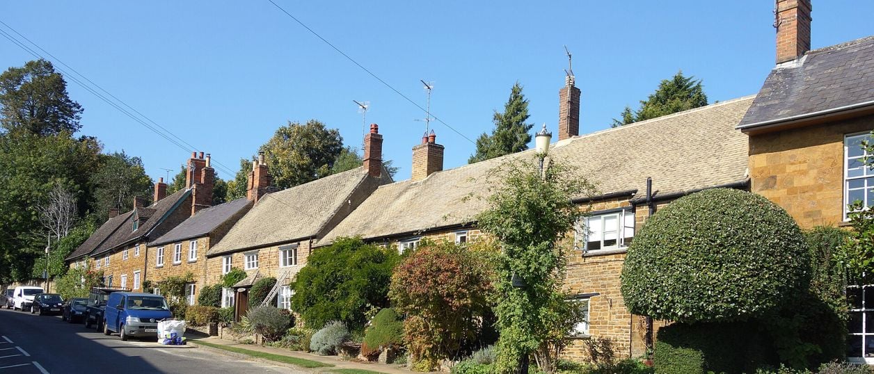
Des Blenkinsopp, CC BY-SA 2.0, via Wikimedia Commons
Adderbury and Bloxham Grove
A 3.1-mile (5.1km) circular walk from the Methodist church in East Adderbury, about an hour and a half of easy walking with stiles. Field paths lead to Bloxham Grove and its small windmill, down to Lower Grove Mill on the Sor Brook, and back to The Green.
- Distance
- 5.1 km (3.2 mi)
- Difficulty
- Easy
- Time
- 1 hr, 30 mins
- Ascent
- 73 m
- Circular
- Circular
The route
Starts at Adderbury Methodist Chapel, High Street and Chapel Lane, East Adderbury Muddy in winterStilesLivestock in fieldsRoad walking Download GPX
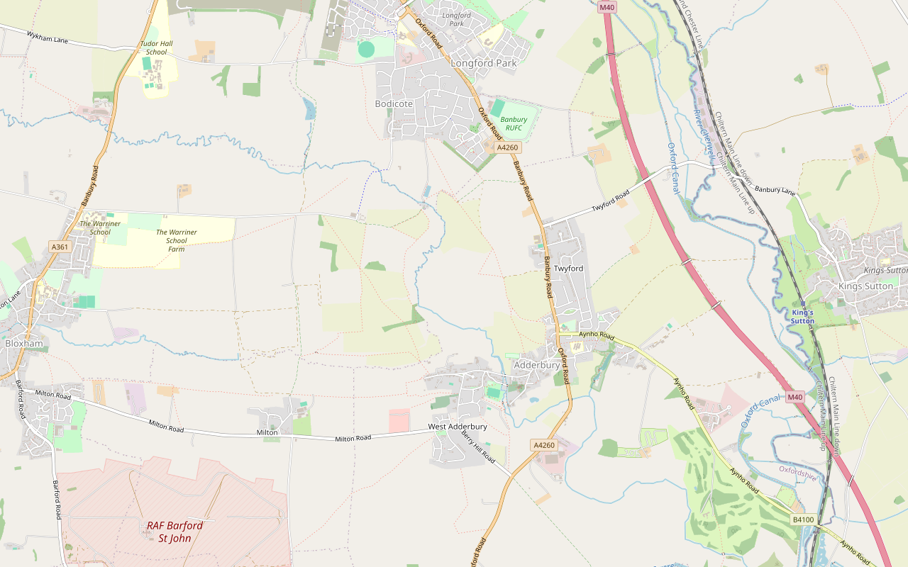
Step by step
-

Step 1: High Street to the end of Manor Road
With the Methodist chapel behind you, walk south-west down the High Street past The Bell, which is on your left. At the bottom, take Water Lane to the right. St Mary's Church is close on your left here, reached by Mill Lane.
Follow the road over the Sor Brook on New Road and up Cross Hill Road. Pass Colin Butler Green, carry on into Manor Road and walk to its far end. This first kilometre is all on village roads.
-
Step 2: Manor Road to Bloxham Grove
At the end of Manor Road the public footpath leaves north-west between stone walls. OpenStreetMap maps stiles here. Go downhill, over a narrow footbridge and through a kissing gate into the meadow, where the ground can be wet.
The path now runs north-west across several fields for about 1.2km. Cherwell's leaflet describes a stile at a field gate, a strip of woodland, then a second stile before the field that slopes up to the bottom of a tree-lined avenue. Go up the avenue to the track junction by the wall of Bloxham Grove. This is the top of the walk, at about 114m, and the windmill stands about 125m away to the west.
- Stiles
- Muddy in winter
-
Step 3: Bloxham Grove to Lower Grove Mill
Turn right, east, along the public bridleway, leaving Bloxham Grove behind. It runs through a gate and gently downhill along a field edge for about 500m to the buildings at Lower Grove Mill.
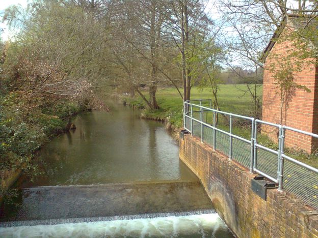
Follow the track between the buildings and over the bridge across the Sor Brook, with the weir beside you, about 3km from the start. Do not go up any private drive at Bloxham Grove.
-
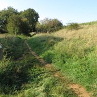
Step 4: Lower Grove Mill to Croft Lane and The Green
Over the bridge, go through the gate and turn right along the bridleway, which runs north-east to the walk's lowest ground. Keep on through a second gate and a third as the line swings south-east onto the public footpath.
Climb steadily across the fields for about 450m, then continue south with the hedge on your left and through a kissing gate. The path reaches a gate at the top corner of a field, where the leaflet recommends the view of the village and its spire ahead of you. A second kissing gate takes you to a farm track about 4.1km from the start.
Near the end of the fields the path bends east along the base of a shallow bank, through scrub, and then south. It comes out on Croft Lane, which you follow downhill to The Green. Turn right along the High Street past The Rookery to the Methodist chapel. Buses towards Oxford stop opposite Green Farm, by The Green.
- Muddy in winter
Sights on the way
The sights this walk passes, numbered as on the map.
-

St Mary's Church, Adderbury
Sight · Church · Adderbury
Adderbury's Grade I church, with a stone spire, a frieze of medieval musicians and grotesques round its aisles, and a chancel built by Richard Winchcombe for New College, Oxford. Open daily and free to look round.
-

Warriner Windmill, Bloxham Grove
Sight · Historic building · Bloxham
A small timber post mill on the high ground at Bloxham Grove, between Bloxham and Adderbury, built in 1865 by the engineer Henry Warriner as a memorial to all windmills. Grade II, with its machinery intact. On farmland, not open, and seen from a footpath nearby.
-
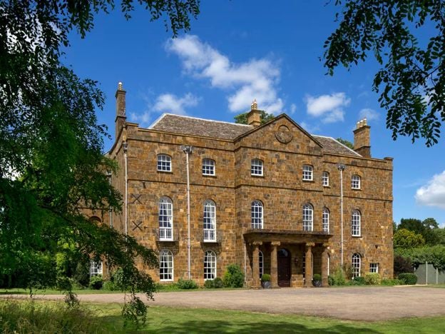
Adderbury House
Sight · Historic building · Adderbury
A private house in Adderbury and what is left of a mansion of the Earls of Rochester and the Dukes of Argyll and Buccleuch. Most of it was pulled down in 1808, and it was enlarged again after 1891. Grade II and not open. Its old water is now the public Adderbury Lakes.
The walk in detail
The Adderbury and Bloxham Grove walk is a 3.1-mile (5.1km) circular route from the Methodist chapel on the High Street in Adderbury, 3 miles south of Banbury. It is easy, with about 73m of climbing, and takes about an hour and a half. There are stiles, and The Bell is a minute from the start.
Most of the route follows the paths of the Adderbury Circular Walk, written by the village's footpath committee and published by Cherwell District Council in 2007, but it runs the other way round. The council's waymarks were set up for the anticlockwise direction, so any you find will point against you. The council gives 3.6 miles for its version. Its current version on Go Jauntly, made with the council and last checked in May 2025, measures 5.2km. This line measures 3.1 miles.
Adderbury: the church, the brook and Manor Road
The first kilometre goes through the old village, so it is the part to take slowly. The High Street drops past The Bell to Water Lane, and St Mary's Church is less than 100m off the line. It is Grade I, and its page says it is open every day from 9.30am to 5pm, so it is an easy first or last stop. Look at the carved friezes outside before you go in.
The Sor Brook divides East from West Adderbury, and you cross it on New Road. Beyond the bridge, the council's leaflet picks out Le Halle Place, where Cross Hill Road meets Manor Road. It was the home of Janet Blunt from 1896, and between 1916 and 1919 she noted down the Adderbury morris dances from William Walton. Manor Road itself, the leaflet says, was known to villagers as Mud End and once made Adderbury cheese. The leaflet is frank that the flavour was poor, which may be why it stopped. Most of these buildings are homes, so look from the road.
Bloxham Grove and the Warriner windmill
The Warriner windmill is the landmark of the walk, and you see it from outside only. It is a small timber post mill, built in 1865 by the engineer Henry Warriner, listed Grade II and not open. The line stays about 125m from it at the top of the climb, and we found no public path right up to it, so stay on the right of way. The leaflet gives the corner of the Bloxham Grove garden wall as the viewpoint, with Bloxham church in the distance beyond.
The leaflet dates Bloxham Grove's yeoman farmhouse to 1715 and says it belonged in the early nineteenth century to George Warriner, a farmer who experimented with new crops and methods. On the avenue below it, look back for Adderbury's spire. The saying is local: Bloxham for length, Adderbury for strength, King's Sutton for beauty.
Lower Grove Mill and the Sor Brook
Lower Grove Mill is where the walk drops to the water, and the bridge is the place to stop. The leaflet says a mill here is recorded in Domesday, that it was called Clare Mill in the fifteenth century, and that Henry Warriner's experimental steam launch, the Firefly, turned round at this spot. The weir and the small gauging station by the bridge are part of the Environment Agency's flood warning network, according to the leaflet.
The leaflet calls the valley bottom a good example of lowland river country, with wet pastures, hedgerows and pollarded willows, and it mentions rare plants and the marsh fritillary butterfly. That account is from 2007, so treat it as a reason to look and not a promise of what you will see. The Sor Brook also marks the boundary between Adderbury and Bloxham parishes.
Where to eat on the walk
Two pubs with pages here stand at the Adderbury end of the walk, so plan to eat before or after it. The Bell is on the line, on the High Street, but opens only from 5pm from Monday to Thursday, and from noon on Fridays, Saturdays and Sundays. Food comes on set nights. For a weekday lunch use The Red Lion, about 140m off the line on The Green, which serves food from breakfast until 9pm every day. Both welcome dogs. The Coach and Horses, a Wadworth pub, stands beside the line on The Green, but we could not confirm its hours, so ring first on 01295 810422.

The Banburyshire newsletter
Events, new places and the best of the season, about once a month. Unsubscribe at any time.
What walkers report
We have no dated walkers' reports for this route to pass on yet, and our own walk-through with the GPX is still to come. The nearest thing is a report to Oxfordshire County Council on FixMyStreet in October 2026, of the path from Croft Lane to the Oxford Road being overgrown. That path branches off beside the line, which does not use it. Our searches in November 2026 found no closure on the route, though the county's notices are not fully searchable, so look for signs.
Cherwell's current version of the walk on Go Jauntly, last checked in May 2025, warns that some field paths turn muddy after wet weather, and counts one stile, several kissing gates and one narrow footbridge. The 2007 leaflet counted two stiles and two narrow footbridges, and warns of grazing animals in several fields. OpenStreetMap maps stiles in other places too, at the end of Manor Road and beside Croft Lane, so allow for more than one. The council says it usually checks its routes once a year, and that many flood in and after wet weather: turn back if the water is deep. Boots are the right call for most of the year. The first kilometre is on village roads.
Parking and getting there
There is no car park in Adderbury. Cherwell's leaflet says there is usually space on the south side of The Green, about 100m from the start, and the walk comes back past it. The S4 stops at the Methodist Church on its way to Banbury, and opposite Green Farm by The Green on its way to Oxford, so this works without a car: our bus page has the details. On the Day of Dance, which fell on 25 April in 2026, the road through the village closed from 10am to 7pm, so check the date first.
To make more of the village, Adderbury Lakes is reached along Lake Walk, east of the main road, and the parish council's nature reserve is an easy addition. Adderbury House is close to The Green. The council's Village Trail, in the same leaflet, is 1.8 miles round the old buildings. Our guide to villages near Banbury sets Adderbury among its neighbours.
Other walks nearby
Three more walks are within a short drive. The Broughton Road to Wroxton Obelisk Circular is a longer field walk on the other side of Banbury. The Banbury Ironstone Heritage Walk leaves from the town itself, and the Edgehill Circular is the one to choose if you want a ridge.
Places on the way
-
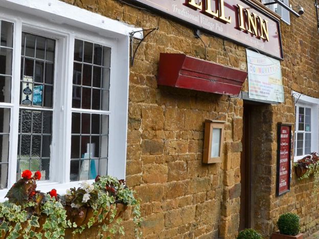
The Bell Inn, Adderbury
Pubs · Adderbury
Adderbury's traditional Hook Norton inn on the High Street, near St Mary's Church, with a suntrap garden, curry on Tuesdays, sourdough pizza on Fridays and stuffed Yorkshires on Sundays.
Dog-friendly
Verified Nov 2026
-
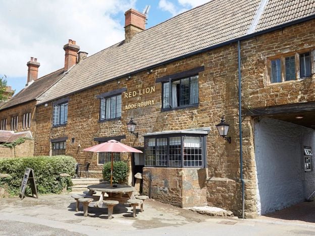
The Red Lion, Adderbury
Pubs · Adderbury
A Grade II listed Greene King pub and inn on The Green at Adderbury, serving food from breakfast to 9pm every day, with a car park, a beer garden and rooms.
Dog-friendly · Family-friendly
Verified Nov 2026
Stay near the start
Inns, cottages and hotels within a short drive of where the walk begins, so you can set off early.
Where to stay in Adderbury-
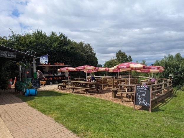
The Pig Place, Adderbury
Camping · Adderbury
A rustic, adults-only campsite beside Nell Bridge Lock on the Oxford Canal near Adderbury, with dogs free, off-lead space, pitches from £12, and a café, bar and music in summer. No showers.
Dog-friendly · Walker-friendly
Verified Nov 2026
-
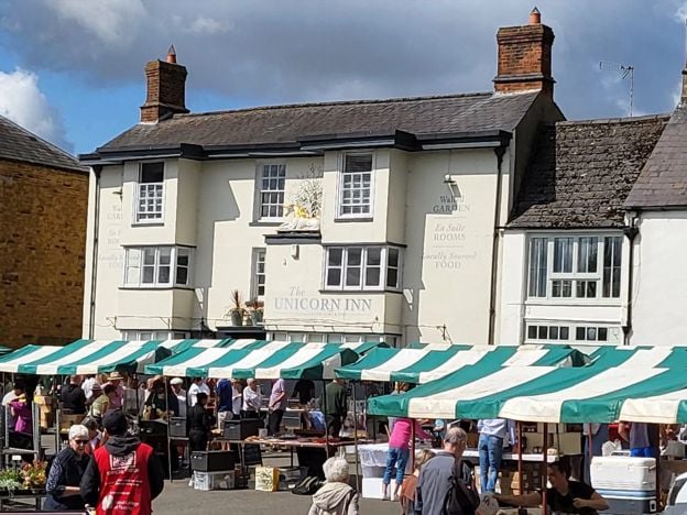
The Unicorn Inn, Deddington
Pubs · Deddington
A Grade II listed inn of the mid 17th century on Deddington Market Place, with open fires, a garden behind, British classics and seven rooms, four of which take dogs.
Dog-friendly · Family-friendly
Verified Nov 2026
-
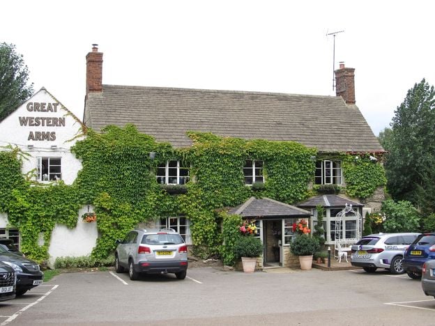
The Great Western Arms, Aynho
Pubs · Aynho
A Hook Norton pub with four rooms between the Oxford Canal and the old Aynho station, about 15.5 miles by road from Silverstone. It sells itself as a base for the circuit, Bicester Village and Blenheim Palace. A small place, so rooms for a race weekend will not last.
Verified Nov 2026
More like this
Stories on this walk
-
Walks near Banbury
Story · Guides · 8 minute read
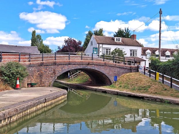
Walks near Banbury: the towpath to Cropredy, the Ironstone Heritage Walk from the station, short circles round Wroxton and Adderbury, the Edgehill ridge, Badby's bluebell wood and the parish walks at Great Tew, Hook Norton and Kings Sutton, with distances, stiles and parking.
More walks to try
-
Broughton Road to Wroxton Obelisk Circular
Walk · Starts in Broughton · 2 hrs · Circular
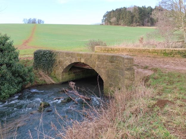
A 4.5-mile (7.3km) circular walk from the car park on Broughton Road, about two hours of moderate walking on field paths. It crosses the Sor Brook, climbs to the Wroxton Obelisk and returns by the other bank. It does not go through Broughton or past the castle.
-
Banbury Ironstone Heritage Walk
Walk · Starts in Banbury · 4 hrs · Circular
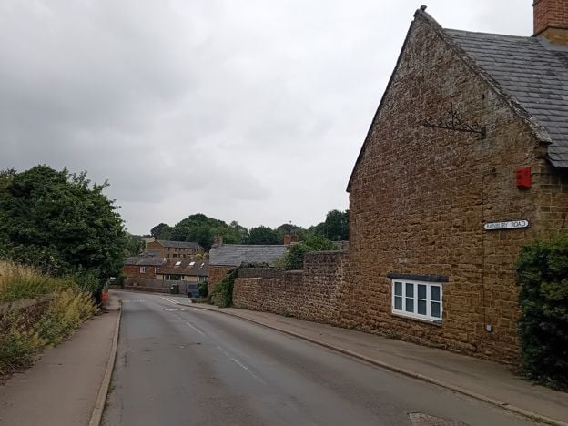
The Banbury Ironstone Heritage Walk is a 9.6-mile (15.5km) moderate circular walk from Banbury station, about four hours with 180m of climbing. It follows the canal, skirts the northern estates, reaches Wroxton and North Newington, and ends at Banbury Cross.
-
Edgehill Circular
Walk · Starts in Edgehill and Radway · 2 hrs, 30 mins · Circular
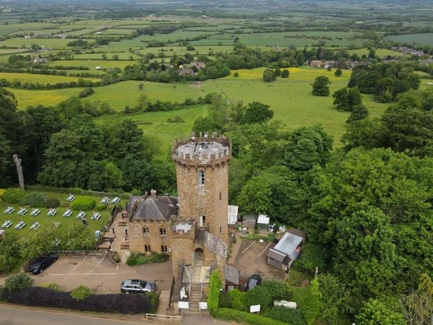
The Edgehill Circular is a 5.4-mile (8.6km) moderate circular walk from the Upton House car park, about two and a half hours with 220m of climbing. It follows the Edge Hill ridge to the Castle pub, returns through Ratley, and has six stiles and 500m on the A422.