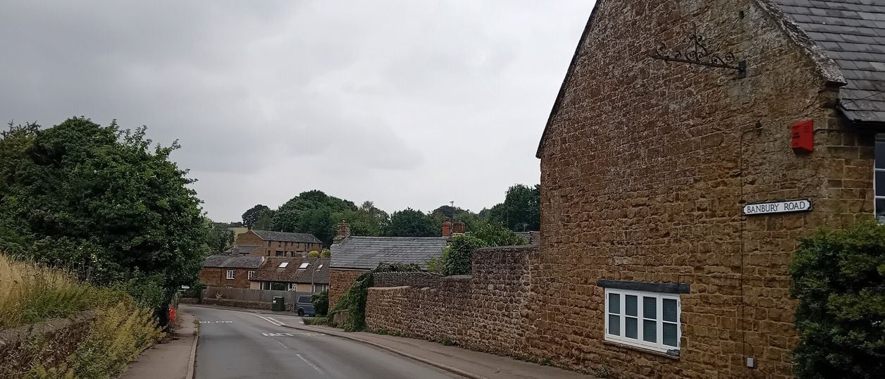
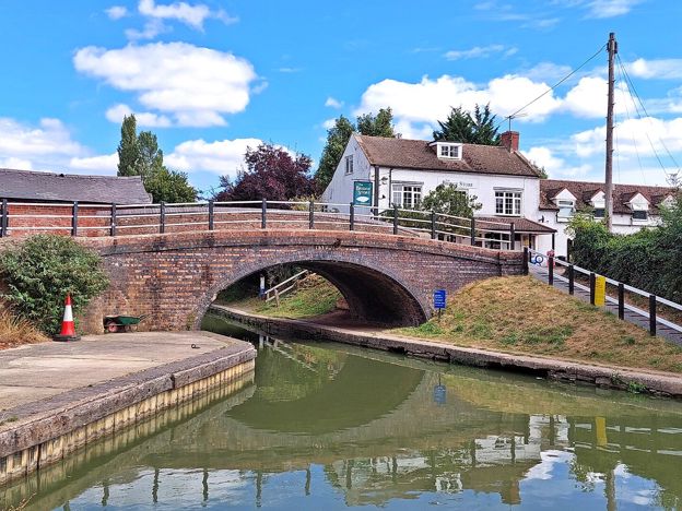
Bikeboy, CC BY-SA 2.0, via Wikimedia Commons
Banbury Ironstone Heritage Walk
The Banbury Ironstone Heritage Walk is a 9.6-mile (15.5km) moderate circular walk from Banbury station, about four hours with 180m of climbing. It follows the canal, skirts the northern estates, reaches Wroxton and North Newington, and ends at Banbury Cross.
- Distance
- 15.5 km (9.6 mi)
- Difficulty
- Moderate
- Time
- 4 hrs
- Ascent
- 180 m
- Circular
- Circular
The route
Starts at Station Road, outside Banbury station Muddy in winterDogs on lead near sheep Download GPX
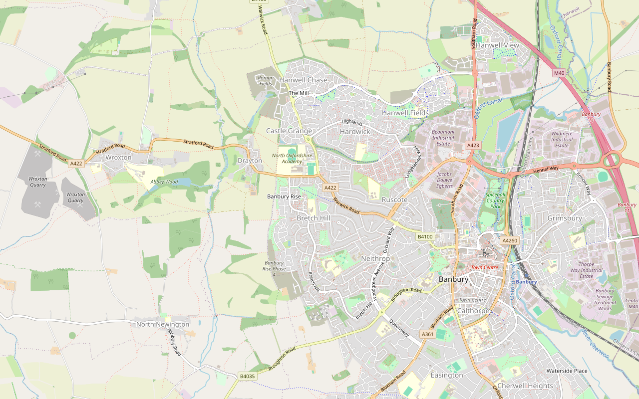
Step by step
-
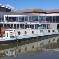
Step 1: Banbury station to the canal and Spiceball
From Station Road, walk west to Bridge Street, cross the Oxford Canal and turn right onto the canalside path behind Castle Quay. You pass Tooley's Boatyard and Banbury Museum within 500m, then The Light. Go down the short steps and carry on north along the towpath for about 1km, with Spiceball Country Park beside you.
After about a mile from the start, leave the towpath for Grimsbury Green, past the Waterworks car park.
-
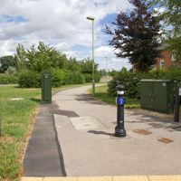
Step 2: The cycle paths to Hanwell Fields
Follow the cycle path west beside Hennef Way and back over the canal, then north beside Southam Road past the retail parks and the Beaumont Industrial Estate. This is about 1.5km of main-road walking on a shared path.
Turn west on the path beside Dukes Meadow Drive and follow it for about 2km through Hanwell Fields. Cross Warwick Road (B4100) with care at about 5.6km, then go through the new streets of Cesar's Grove and Roman Fields Avenue.
-
Step 3: Over the old railway to Drayton and Wroxton
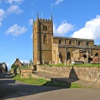
From Roman Fields Avenue, take the footway south for about 650m. It crosses the line of the old ironstone railway, and about 100m of it is not mapped, so keep straight on towards the houses. At Queens Crescent in Drayton, follow the service road past the village hall and the Roebuck Inn to the A422, Stratford Road.
Turn right along the A422. OpenStreetMap maps no pavement for about 230m as the road crosses the Sor Brook and the limit rises to 60mph, so take care. From there a compacted footway runs beside the road for about 800m into Wroxton. Follow Stratford Road through the edge of the village and past the Wroxton House Hotel.
-
Step 4: Through the Abbey park to North Newington
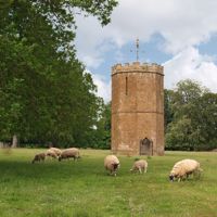
Turn left down Mills Lane, then along Dark Lane to the public footpath by Wroxton College. Go through the gates and follow the footpath south, with the dovecote to your right and a kissing gate at about 8.7km.
Keep south on the field path for about 1.7km, past French's Covert and through a short unmapped stretch at about 9.9km, down to Main Street in North Newington.
- Muddy in winter
- Dogs on lead
-
Step 5: North Newington back to the edge of Banbury
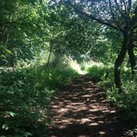
Turn left, then along School Lane past the primary school for about 350m. At the end, by Park Farm, go through the gate and take the footpath east. It runs for about 1.6km across the fields, with Withycombe Covert and Milestone Farm near it, to the new houses at Bretch Hill.
OpenStreetMap maps a new road under construction across the line at about 12.5km, so follow any signs you find. Carry on along the public footpath to Bretch Hill.
- Muddy in winter
-
Step 6: Bretch Hill to the Cross and the station
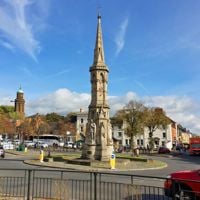
Walk down Bretch Hill for about 500m, turn into Lennox Gardens and follow the paved path through to Broughton Road. Follow the pavement east for about 1.2km along Broughton Road and West Bar Street to the Fine Lady and Banbury Cross.
From the Cross, walk down the High Street and George Street to Cherwell Street. Turn left along it to Bridge Street, then right over the canal to Station Road.
Sights on the way
The sights this walk passes, numbered as on the map.
-
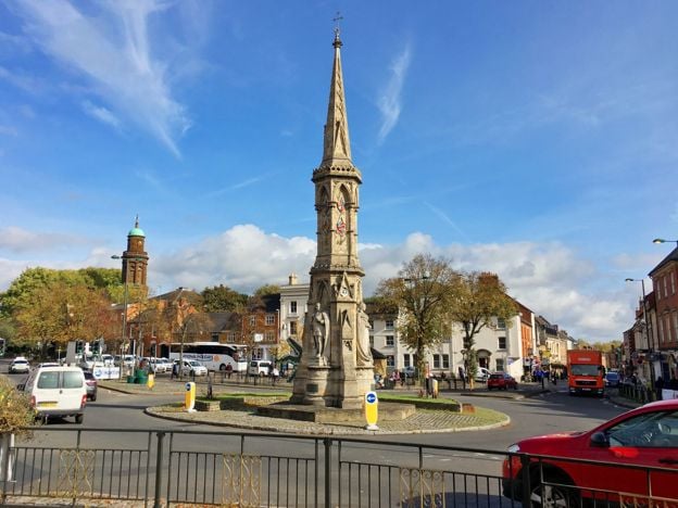
Banbury Cross
Sight · Monument · Banbury
The cross of the nursery rhyme stands at the top of Banbury High Street, but it is a Victorian monument of 1858 to 1859, put up about 250 years after the town's medieval crosses were pulled down. Grade II*, free and seen from the street at any time.
-
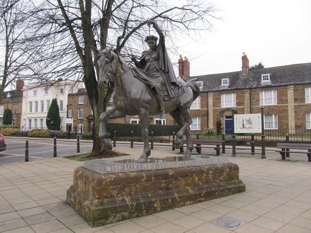
Fine Lady statue, Banbury
Sight · Monument · Banbury
A bronze of the rhyme's fine lady on her white horse, on a Hornton stone plinth where South Bar meets West Bar in Banbury. The people of the town paid for it, and the Princess Royal unveiled it in 2005. Free to see at any time.
-
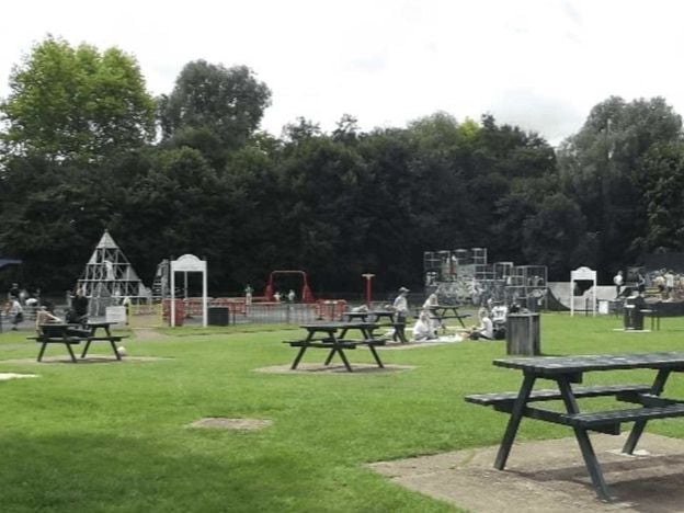
Spiceball Country Park, Banbury
Sight · Common or park · Banbury
Banbury's largest park, 26 acres split by the River Cherwell with the Oxford Canal along one edge: play area and skate ramps on the town side, woodland walks and nature trails across the wooden bridges. Free, with free parking on Grimsbury Green.
-
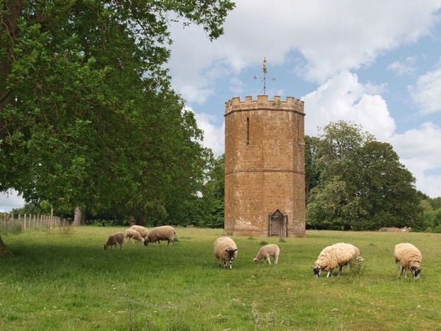
Wroxton Dovecote
Sight · Historic building · Wroxton
A Gothic dovecote of 1745 by Sanderson Miller in the park of Wroxton Abbey, west of Banbury, built both to house pigeons and to look like a small castle from the house. Ironstone, polygonal and Grade II*. In the Abbey's park, so seen from a distance.
-
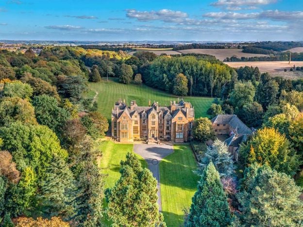
Wroxton Abbey
Sight · Historic building · Wroxton
A Jacobean house of about 1618 west of Banbury, on the site of a medieval priory and long the home of the Norths. Grade I. It is a college and closed to visitors. It passed to an alumni-led group in 2025 to 2026, and a public footpath crosses the grounds.
The walk in detail
The Banbury Ironstone Heritage Walk is a 9.6-mile (15.5km) circular walk from Banbury station, about four hours with 180m of climbing, so moderate. It follows the Oxford Canal, circles the northern estates, reaches Drayton, Wroxton and North Newington, then returns to Banbury Cross.
Be clear what this is: about 7 miles of town edge, pavement and roadside, with roughly 2.5 miles of fields in the middle, between Wroxton and Bretch Hill. If you want countryside and not a tour of how Banbury has grown, take a shorter walk from the list at the bottom. Nobody from this guide has walked it yet, and a walk-through is pending.
The ironstone in the walk
The name comes from the rock under the western half of the route and the trade that dug it up. Between Banbury and Wroxton the walk twice meets the course of the Oxfordshire Ironstone Railway, which OpenStreetMap still traces. It took ore from the quarries around Wroxton to the main line at Banbury from about 1919. The company closed in 1967, and the track had gone by the middle of 1968. Little of it can be seen on this route, and the suburbs of Hanwell Fields now sit near its line. Our story of Hornton stone and the ironstone villages tells the full history.
The stone itself shows up at Wroxton, whose older cottages are the rust-gold you have come to see. They are two-storey coursed ironstone, mostly of the seventeenth or eighteenth century, and many are thatched.
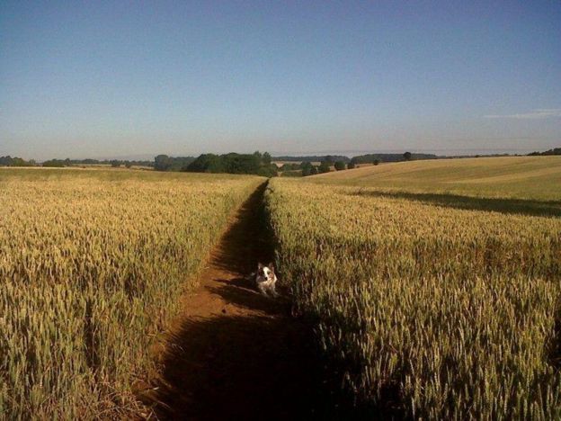
The canal and Spiceball at the start
The first mile is the best of the town section. Tooley's Boatyard, whose working dry dock dates in part from 1778, and the free Banbury Museum and Gallery are both beside the line within 500m of the start, though either would take an hour you probably want to keep for later. Spiceball Country Park, 26 acres split by the River Cherwell, runs along the towpath after that. The next 3 miles are not worth lingering over: cycle paths past retail parks, warehouses and new estates.
Wroxton and the Abbey park
Wroxton is the turning point, at about 5 miles, and the village is worth a look. The Abbey is a college and closed to visitors, but a public footpath crosses its grounds, and this route follows it past the Wroxton Dovecote, Sanderson Miller's Gothic eye-catcher of 1745, which you see from a distance. Wroxton Abbey has its own page on the grounds and the change of ownership. The village website says dogs are not permitted in the grounds, and a public right of way does not depend on that, but keep yours on a lead and on the line.
The Wroxton Obelisk stands in the fields about 370m east of the path at its nearest. The route does not reach Drayton Arch, the sham ruin, which has its own page. In North Newington the route passes through without stopping: there is little to detain you, as our guide to the village says plainly.

The Banburyshire newsletter
Events, new places and the best of the season, about once a month. Unsubscribe at any time.
Where to eat on the walk
Plan lunch before you set off, because the good stops are not spaced evenly. The Roebuck Inn at Drayton is on the line at about 4 miles, and dogs are welcome, but it is closed on Mondays and Tuesdays and opens at 4pm on Wednesdays and Thursdays. Wroxton has no village pub: the White Horse and the North Arms have both shut. The Wroxton House Hotel has a restaurant open to non-residents, just off the route. We name no pub at North Newington, because we could not show one trading on its own website.
The finish is the easy part. The route comes back past the Fine Lady and the Cross to the High Street, a couple of minutes from Ye Olde Reine Deer Inn on Parsons Street and from the Market Place.
What walkers should know before setting out
As of November 2026 we have found no reports of closed paths on this route, and Oxfordshire's footpath closures in Banbury this summer were elsewhere. Three things to watch. The A422 at the Sor Brook has about 230m with no mapped pavement and a 60mph limit. The B4100 crossing is on a fast road. And Bretch Hill is still being built on, so paths near the new houses may change. Just east of School Lane in North Newington, Oxfordshire County Council made an order on 3 August 2026 to divert short stretches of North Newington footpaths 1 and 4 by Great Oak Barn; it was not confirmed when we checked, so follow any signs there. The fields are likely to be muddy after rain. OpenStreetMap maps no stiles on the line, though it may not have them all.
Parking and getting there
The train is the simple way, since the walk starts outside Banbury station. To drive, our parking guide gives every tariff: council long-stay car parks such as Bolton Road charge £5 for four hours and £7.50 for the day up to 6pm (2026). For a night in the town, the Whately Hall Hotel is beside the Cross.
Other walks nearby
Three shorter walks suit a half day. The Broughton and Wroxton circular covers the same valley with far less tarmac. Adderbury and Bloxham Grove is the short walk south of the town, and the Edgehill Circular is the ridge walk, a drive away to the north-west. For the town alone, the Banbury heritage walk takes the Cross, the church, Parsons Street and the canal in under a mile.
Places on the way
-
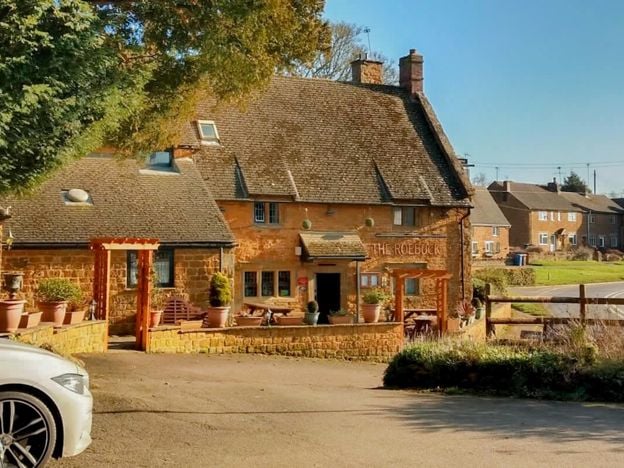
The Roebuck Inn, Drayton
Pubs
A Hook Norton pub in a late 17th-century listed building on the A422 at Drayton, just outside Banbury, with a south-facing courtyard, a modern British menu, a car park and dogs welcome.
Dog-friendly
Verified Nov 2026
-
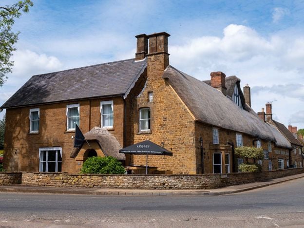
The Wroxton Hotel
Hotel · Wroxton
A 32-room hotel made from three adjoining stone cottages, partly dating from 1649, on the edge of thatched Wroxton, a few minutes' drive from junction 11 of the M40, with free parking and its own tea room.
Dog-friendly · Wedding venues
Verified Nov 2026
-
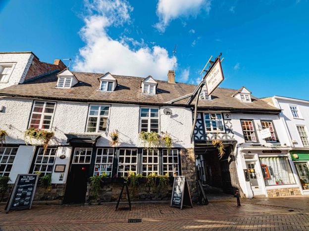
Ye Olde Reine Deer Inn, Banbury
Pubs · Banbury
A Parsons Street pub that dates itself to 1570 and calls itself Banbury's oldest, a Hook Norton house with the panelled Globe Room of the 1630s, serving food every day from noon to 9pm.
Car-free
Verified Nov 2026
-
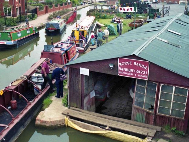
Tooley's Historic Boatyard
Historic houses and heritage · Banbury
A working dry dock and forge on the Oxford Canal in Banbury, in use since 1778 and now hemmed in by Castle Quay. Small museum in the chandlery, Saturday boat trips in summer, and blacksmith courses. A scheduled monument and the start of Tom Rolt's Narrow Boat.
Car-free
Verified Nov 2026
-
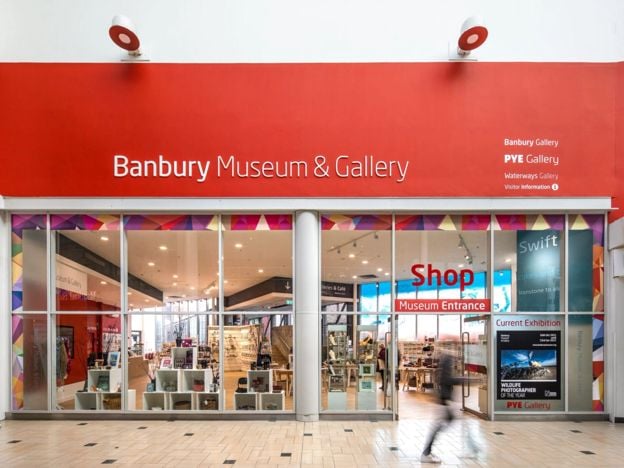
Banbury Museum and Gallery
Museums and galleries · Banbury
Banbury's free town museum, on the Oxford Canal with an entrance in Castle Quay: Bronze Age finds, a cannon from Banbury Castle, plush cloth and a canal gallery, with paid touring exhibitions and a canalside café.
Family-friendly · Rainy days · Car-free
Verified Nov 2026
Stay near the start
Inns, cottages and hotels within a short drive of where the walk begins, so you can set off early.
Where to stay in Banbury-
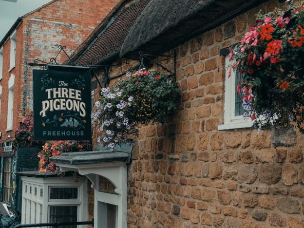
The Three Pigeons, Banbury
Pubs · Banbury
A Grade II listed 17th-century inn, partly thatched, on Southam Road, Banbury, with real ales and ciders, a courtyard, Smash Cow street food from Thursday to Saturday and three en-suite rooms.
Dog-friendly · Car-free
Verified Nov 2026
-
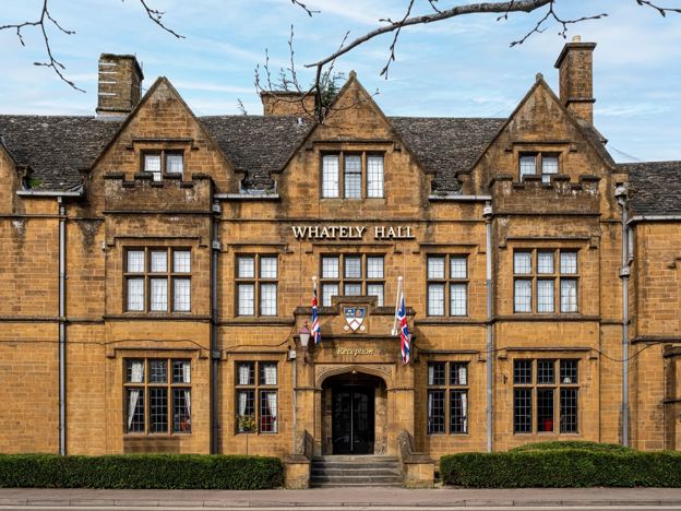
Whately Hall Hotel, Banbury
Hotel · Banbury
A Grade II listed 17th-century inn, now a 71-room hotel on Horse Fair in the middle of Banbury, with gardens, an oak-panelled restaurant and six EV chargers.
Dog-friendly · Family-friendly · Wedding venues
Verified Nov 2026
-
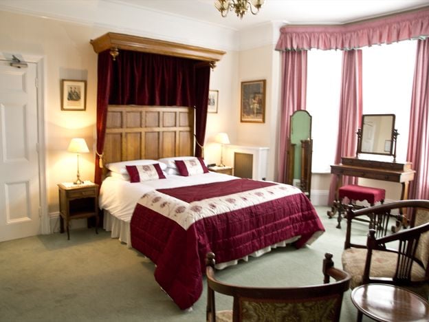
Banbury Cross Bed and Breakfast
B&B · Banbury
A family-run Victorian B&B on Broughton Road, Banbury, with seven bedrooms, about 370m from Banbury Cross, with free off-road parking, cooked breakfasts and rates from £77. No under-18s.
Car-free
Verified Nov 2026
More like this
Stories on this walk
-
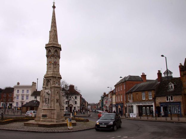
Banbury heritage walk: a self-guided town centre route
Story · Guides · 6 minute read
A self-guided heritage walk round Banbury town centre: the Fine Lady, the Cross, St Mary's, Parsons Street, the Market Place and the canal. It is under a mile (1.3km) and free, taking about an hour with stops, or two with the museum.
-
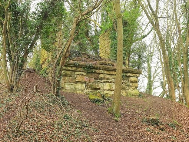
The ironstone railways of Banburyshire: Wroxton, Hook Norton and Edge Hill
Story · History · 7 minute read
For half a century the hills west of Banbury were dug for iron ore and carried away by rail: a busy private line from Wroxton, a narrow gauge tramway at Hook Norton and a light railway on Edge Hill that barely ran. What they were, why they closed and what you can still trace.
-
Walks near Banbury
Story · Guides · 8 minute read
Walks near Banbury: the towpath to Cropredy, the Ironstone Heritage Walk from the station, short circles round Wroxton and Adderbury, the Edgehill ridge, Badby's bluebell wood and the parish walks at Great Tew, Hook Norton and Kings Sutton, with distances, stiles and parking.
More walks to try
-
Broughton Road to Wroxton Obelisk Circular
Walk · Starts in Broughton · 2 hrs · Circular
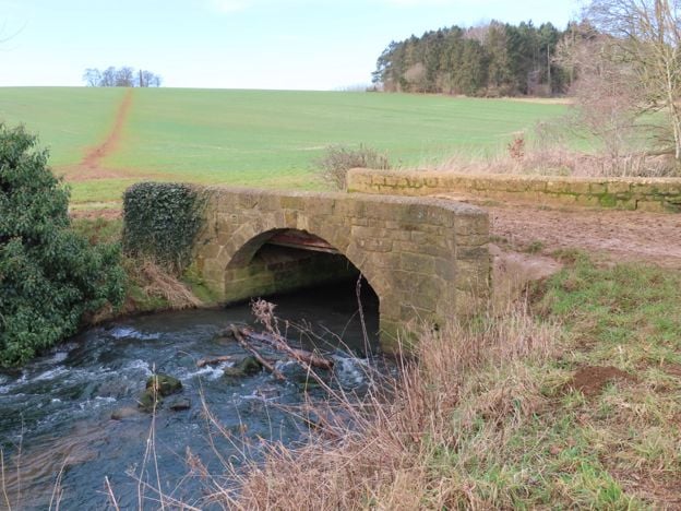
A 4.5-mile (7.3km) circular walk from the car park on Broughton Road, about two hours of moderate walking on field paths. It crosses the Sor Brook, climbs to the Wroxton Obelisk and returns by the other bank. It does not go through Broughton or past the castle.
-
Adderbury and Bloxham Grove
Walk · Starts in Adderbury · 1 hr, 30 mins · Circular
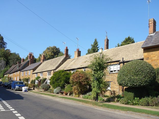
A 3.1-mile (5.1km) circular walk from the Methodist church in East Adderbury, about an hour and a half of easy walking with stiles. Field paths lead to Bloxham Grove and its small windmill, down to Lower Grove Mill on the Sor Brook, and back to The Green.
-
Edgehill Circular
Walk · Starts in Edgehill and Radway · 2 hrs, 30 mins · Circular
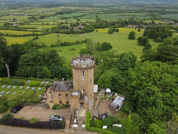
The Edgehill Circular is a 5.4-mile (8.6km) moderate circular walk from the Upton House car park, about two and a half hours with 220m of climbing. It follows the Edge Hill ridge to the Castle pub, returns through Ratley, and has six stiles and 500m on the A422.