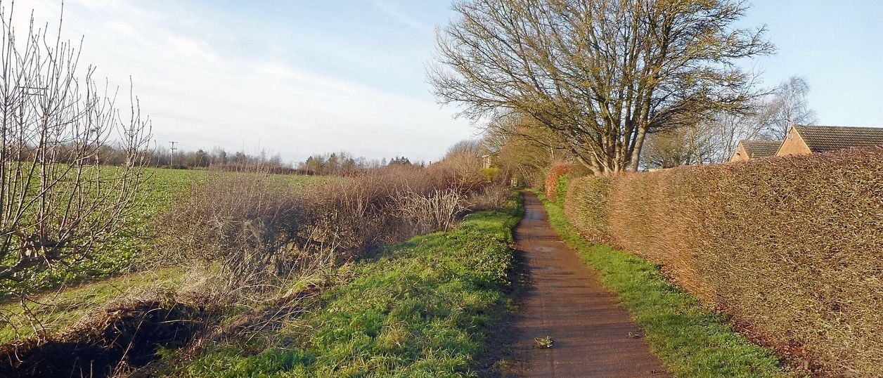
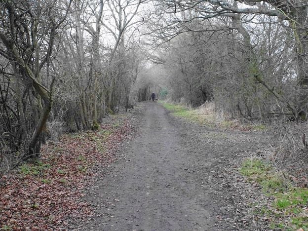
Des Blenkinsopp, CC BY-SA 2.0, via Wikimedia Commons
Banbury Fringe Circular Walk
A 10.6-mile (17.1km) waymarked circular walk round the edge of Banbury, moderate and about five hours: the Oxford Canal south to Bodicote, the Salt Way past Crouch Hill, field and wood paths by Giant's Cave, and an old ironstone railway back to the canal.
- Distance
- 17.1 km (10.6 mi)
- Difficulty
- Moderate
- Time
- 5 hrs
- Ascent
- 104 m
- Circular
- Circular
The route
Starts at Riverside car park, Spiceball Park, Banbury (OX16 2AY) follows the Banbury Fringe Circular Walk for a while Muddy in winterSteep sectionRoad walkingLivestock in fields Download GPX
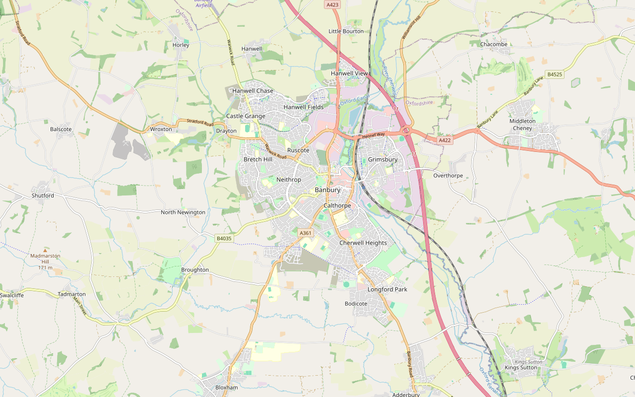
Step by step
-
Step 1: Spiceball Park to Bodicote along the canal
From the Riverside car park, head towards the play area and the Spiceball Park sign, and bear left to the Oxford Canal towpath. Turn left and follow the towpath south past Banbury Museum and Castle Quay. Stay on this side at the bridge by Tooley's Boatyard, go down the ramp by the Mill Arts Centre, and keep to the towpath under the numbered bridges, from 165 up to 172.
At bridge 172, Nadkey Bridge, about 3.2km from the start, leave the canal up a short steep bank, cross the bridge and go through the gate. Climb with the trees on your left to a second gate, then follow the track straight on through the Longford Park estate, past gates, to the Oxford Road. Cross at the light-controlled crossing on your left.
- Steep section
- Muddy in winter
-
Step 2: Bodicote and the Salt Way
Go straight on along Broad Gap into Bodicote, across Chapel Lane and along the narrow pavement by the stone wall. At the end turn right along High Street, which becomes White Post Road, past the playing field and Bodicote House, the council's offices. Where the road bends away, keep to the pavement by the hedge, cross at the zebra crossing and turn right onto the Salt Way.
Follow the Salt Way west for about a mile, a green lane between hedges. Cross the Bloxham Road at the pedestrian lights on your left and pick the Salt Way up again on the far side. It passes below Crouch Hill on your right, where a gate opposite a paved path gives a detour to the top, then bends right to the Broughton Road. Cross with great care: the council's guide warns that the traffic is fast.
- Muddy in winter
-
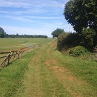
Step 3: Giant's Cave and the woods to Drayton
Go up two steps and down eleven into Giant's Cave park, where the path is permissive. Cross the bridge, turn right and follow the signed route through the trees and up the steps, then along the field edge and up a steep field with the trees on your left.
Near the field corner the path drops steeply through trees. Turn right downhill along the open field, then right again at the bottom onto a public footpath that climbs through woodland for about 400m. The council's guide warns that this stretch can be wet and muddy, and the path hard to follow: keep straight on. At the top, turn left through a short strip of wood and follow the farm tracks north towards Drayton, with paddocks on your left, onto a fenced, surfaced track and a farm road to the A422.
- Steep section
- Muddy in winter
-
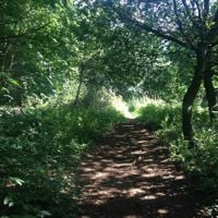
Step 4: Bretch Hill and the Mineral Railway Path
Turn right along the pavement of the A422, cross Bretch Hill with care, and carry on past North Oxfordshire Academy, where there is no pavement across the entrance. At the big junction, turn left up Warwick Road, cross Ludlow Drive, then cross Warwick Road at the light-controlled crossing and turn left. Turn right at the roundabout and follow the paths through the estate down to the Mineral Railway Path.
Follow the old railway line east through the trees, past a rock face, to the Ironstones road. Cross, follow the pavement left and almost at once bear right onto a grass track. Go through the tunnel under Highlands, or cross the road above it, and keep right where the path forks, past a play area and along the top of an embankment. At its end the path zigzags steeply down to a stream.
- Steep section
-
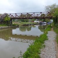
Step 5: Southam Road and back along the canal
Follow the stream path, cross a service road and go down the steps on the far side. At the Southam Road, turn right along the pavement. There is no controlled crossing: cross opposite the canal bridge, waiting for a long gap in the traffic. Go down the ramp, follow the fenced walkway left to the towpath at bridge 161, and turn left. Follow the towpath south for about 1.5km, under the A422, back to Spiceball Park and the start.
Sights on the way
The sights this walk passes, numbered as on the map.
-
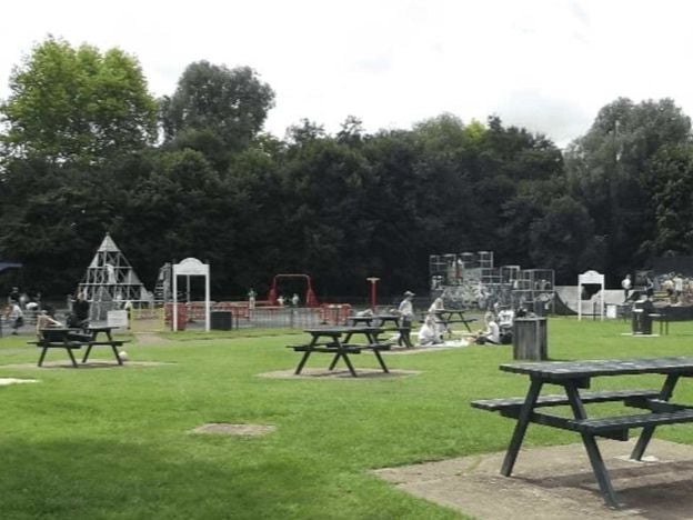
Spiceball Country Park, Banbury
Sight · Common or park · Banbury
Banbury's largest park, 26 acres split by the River Cherwell with the Oxford Canal along one edge: play area and skate ramps on the town side, woodland walks and nature trails across the wooden bridges. Free, with free parking on Grimsbury Green.
-

Giant's Cave, Banbury
Sight · Common or park · Banbury
A patch of old rough pasture off the Broughton Road on the edge of Banbury, called Giant's Cave and said by legend to hide a tunnel to Broughton Castle. One account calls it a late medieval quarry. It is free, and a stop on Cherwell's Banbury Fringe walk.
The walk in detail
The Banbury Fringe Circular Walk is a 10.6-mile (17.1km) loop round the edge of Banbury, devised by Cherwell District Council and waymarked clockwise all the way. It is moderate, with about 104m of climbing and a few short, steep slopes, and takes about five hours. The council gives it as 10 miles (16.1km): its leaflet says up to four hours and its Go Jauntly guide five and a half. Our line measures a little longer.
It is a walk of four quarters: the Oxford Canal through the town and south to Bodicote; the Salt Way, an old green lane, west to Giant's Cave; fields and woods north to Drayton; and an old ironstone railway back to the canal. The council's leaflet splits it at those points into four shorter sections of 2.25 to 2.75 miles, each with parking, so you can walk it in pieces.
The canal and Bodicote
The first 3km are on the towpath, past Tooley's Historic Boatyard, which says it has worked continuously since 1778, and Castle Quay, which the council's guide says stands on part of the site of Banbury Castle, besieged twice in the Civil War. By the Mill Arts Centre a canalside sculpture by Michael Fairfax carries Jamie McKendrick's poem Flow. South of the station the town drops away, and at Nadkey Bridge the route climbs out of the valley through the new Longford Park estate.
Bodicote is the next village, a big one with an old centre that the council's guide calls a conservation area. The route keeps to its edge, past Bodicote House, now the council's offices. For a drink, the Plough is on Bodicote's High Street, a short detour from the route.
The Salt Way and Crouch Hill
The Salt Way is the best mile of the walk: a hedged green lane that the council's guide describes as part of the old road from Droitwich towards London, thought to have carried salt. It has been part of the National Cycle Network's route 5 since 2000, so share it with bikes. Above it to the north stands Crouch Hill, the highest point near the town. The council's guide says Sir William Waller's parliamentarians held it in June 1644 before the battle at Cropredy Bridge, and royalist cavalry used it that October to relieve Banbury Castle.
Giant's Cave is a patch of old pasture off the Broughton Road, part of an area called the Bretch, the council says, a stony spot of hills and hollows. Legend has a tunnel running from it to Broughton Castle, nearly a mile away. It is only a legend, and our page on Giant's Cave sets out what is known.
Fields, woods and the old railway
North of Giant's Cave the walk is at its most rural and its muddiest: two steep field slopes, a climb through a wet wood and farm tracks with views back over the valley. The council's guide warns that the woodland path can be hard to follow, so keep straight on and watch for the waymarks. From the farm road towards Drayton you can see Seed of Change over the hedge, a sculpture in the new housing designed by the artists of Planet Art with children from local schools and installed in 2023.
The last stretch follows the Mineral Railway Path. The council's guide says German prisoners of war built the line in 1917 to carry ironstone from the Wroxton quarries to the main line, and that it closed in 1967. One rock face along it is a geological Site of Special Scientific Interest. It is a quiet green corridor between housing estates, with a corrugated tunnel under Highlands.
The Banburyshire newsletter
Events, new places and the best of the season, about once a month. Unsubscribe at any time.
Roads to take care on
Most of the walk is on paths, but three road crossings need care. The council's guide warns that traffic on the Broughton Road is fast, that there is no pavement across the North Oxfordshire Academy entrance on the A422, and that there is no controlled crossing on the Southam Road near the end, where you cross opposite the canal bridge. Take the Southam Road slowly, especially with children.
Getting there and the route
Banbury station and bus station are both a short walk from the canal, and the council's guide shows where to join from each. By car, use the Riverside car park at Spiceball Park or another town centre car park. For a shorter canal walk with a pub at the end, the Oxford Canal from Banbury to Cropredy heads north from the same start. The Banbury Ironstone Heritage Walk explores the quarry country west of the town.
This route is drawn, not recorded: we drew it along paths mapped in OpenStreetMap, through the places the council's guides name in order, and it measures about 6% longer than the council's figure. Follow the waymarks where they differ from the line. Nobody from this guide has walked it yet, and a walk-through is still to come.
Places on the way
-
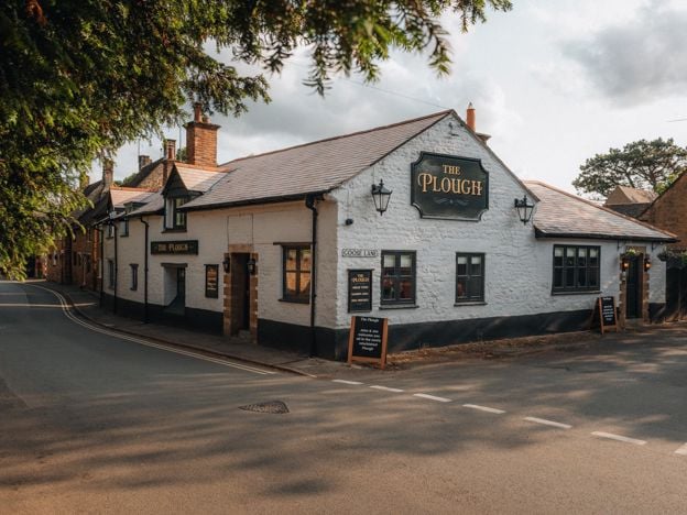
The Plough, Bodicote
Pubs
A Wadworth village pub on Bodicote High Street, about two miles south of Banbury centre, with real ales, a garden, a pub menu with small plates and sourdough sandwiches, and Sunday roasts.
Dog-friendly · Family-friendly
Verified Nov 2026
-
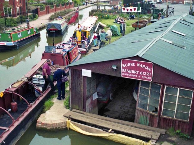
Tooley's Historic Boatyard
Historic houses and heritage · Banbury
A working dry dock and forge on the Oxford Canal in Banbury, in use since 1778 and now hemmed in by Castle Quay. Small museum in the chandlery, Saturday boat trips in summer, and blacksmith courses. A scheduled monument and the start of Tom Rolt's Narrow Boat.
Car-free
Verified Nov 2026
-

Banbury Museum and Gallery
Museums and galleries · Banbury
Banbury's free town museum, on the Oxford Canal with an entrance in Castle Quay: Bronze Age finds, a cannon from Banbury Castle, plush cloth and a canal gallery, with paid touring exhibitions and a canalside café.
Family-friendly · Rainy days · Car-free
Verified Nov 2026
Stay near the start
Inns, cottages and hotels within a short drive of where the walk begins, so you can set off early.
Where to stay in Banbury-
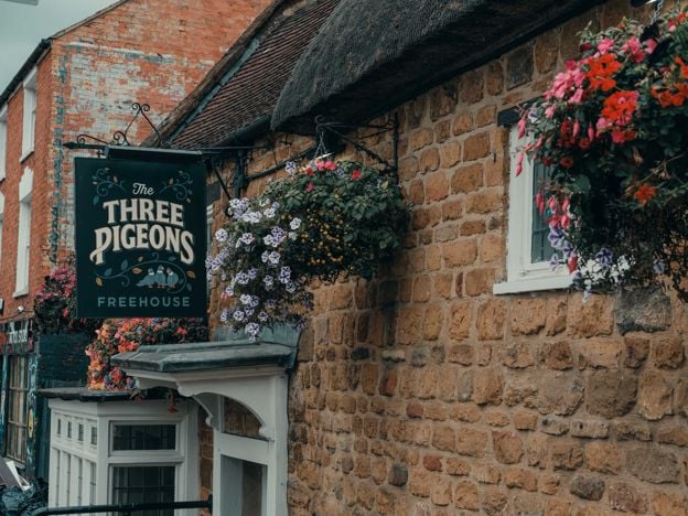
The Three Pigeons, Banbury
Pubs · Banbury
A Grade II listed 17th-century inn, partly thatched, on Southam Road, Banbury, with real ales and ciders, a courtyard, Smash Cow street food from Thursday to Saturday and three en-suite rooms.
Dog-friendly · Car-free
Verified Nov 2026
-
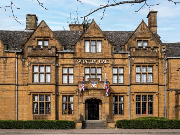
Whately Hall Hotel, Banbury
Hotel · Banbury
A Grade II listed 17th-century inn, now a 71-room hotel on Horse Fair in the middle of Banbury, with gardens, an oak-panelled restaurant and six EV chargers.
Dog-friendly · Family-friendly · Wedding venues
Verified Nov 2026
-
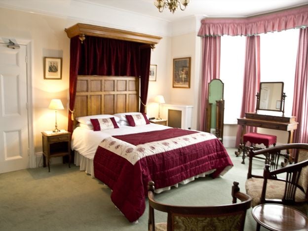
Banbury Cross Bed and Breakfast
B&B · Banbury
A family-run Victorian B&B on Broughton Road, Banbury, with seven bedrooms, about 370m from Banbury Cross, with free off-road parking, cooked breakfasts and rates from £77. No under-18s.
Car-free
Verified Nov 2026
More like this
More walks to try
-
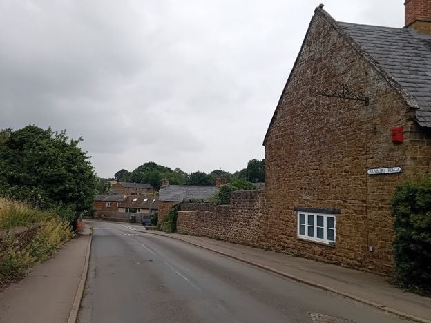
Banbury Ironstone Heritage Walk
Walk · Starts in Banbury · 4 hrs · Circular
The Banbury Ironstone Heritage Walk is a 9.6-mile (15.5km) moderate circular walk from Banbury station, about four hours with 180m of climbing. It follows the canal, skirts the northern estates, reaches Wroxton and North Newington, and ends at Banbury Cross.
-
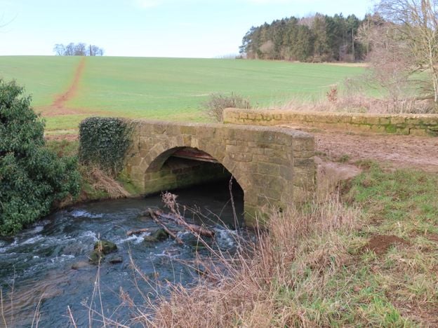
Broughton Road to Wroxton Obelisk Circular
Walk · Starts in Broughton · 2 hrs · Circular
A 4.5-mile (7.3km) circular walk from the car park on Broughton Road, about two hours of moderate walking on field paths. It crosses the Sor Brook, climbs to the Wroxton Obelisk and returns by the other bank. It does not go through Broughton or past the castle.
-
North Newington and Wroxton Circular
Walk · Starts in North Newington · 2 hrs · Circular
A 3.3-mile (5.3km) circular walk from Main Street, North Newington, taking about two hours of moderate walking. It follows field paths to the Sor Brook, climbs past the Wroxton Obelisk into Wroxton and returns over the fields.