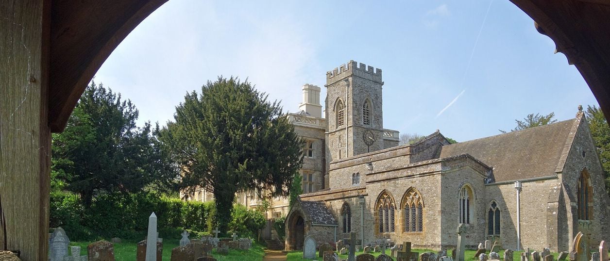
Des Blenkinsopp, CC BY-SA 2.0, via Wikimedia Commons
North Aston, the Causeway and Somerton Mill
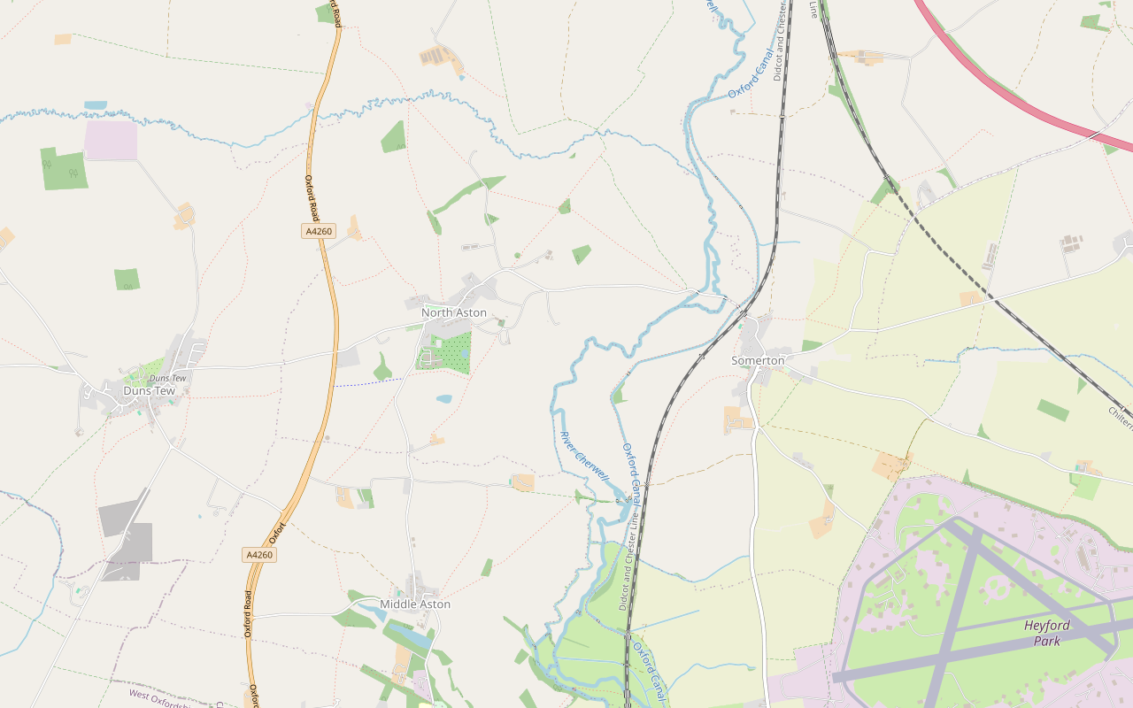
A 5.2-mile (8.4km) moderate circular walk from North Aston Green, about three hours. It crosses the Cherwell meadows on an old causeway by Somerton Mill, follows the Oxford Canal north and climbs home past Bestmoor and North Aston church. It floods after rain.
- Distance
- 8.4 km (5.2 mi)
- Difficulty
- Moderate
- Time
- 3 hrs
- Ascent
- 81 m
- Circular
- Circular
The route
Starts at North Aston Green, North Aston (OX25 6HT) Muddy in winterLivestock in fieldsRoad walkingDogs on lead near sheep Download GPX
Step by step
-
Step 1: North Aston to Grange Farm
With the green on your right, walk to the end of it and turn left onto the lane to Middle Aston. Pass Nicholsons' nursery on the left and follow the lane as it bears left. It has no pavement, so watch for cars.
Ignore the footpath signs on either side and the metal gate on your left, and keep on along the lane past the ornate gates, the views of the valley opening through the trees, and Hendon Farm. At the crossroads, about 1.3km from the start, turn left on the bridleway signed Cherwell Valley Walk towards Grange Farm.
-
Step 2: The Causeway and Somerton Mill
Just before the farmhouse, bear right onto the track, go through the gateway and then the metal field gate straight ahead, not the one to the right. The guide says this gate is tricky to open and there may be livestock beyond, so shut it behind you. Keep close to the field edge, straight on towards the trees.
Go through the metal bridle gate onto the Causeway, the old raised way across the wet Cherwell meadows to Somerton Mill. It is narrow, heavily rutted in places and overhung with branches. At the next gate the guide warns that the stretch beyond is often flooded by the river after wet weather: turn back if it is too wet.
Cross the River Cherwell and follow the track past Somerton Mill. Just before the next bridge, go through a gate on your left, turn right and carry on to the canal. Do not go through the metal gate by bridge 199: turn left onto the grassy towpath.
- Muddy in winter
-
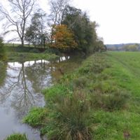
Step 3: The towpath to Somerton's bridge
Follow the towpath north for about 1.8km. The guide says the first section is narrow, overgrown in summer and flooded in winter, so use the adjoining field edge if you need to, and watch for potholes where the bank is eroded.
Go through a metal gate, avoiding the muddy patch where water leaks from the canal, and close it behind you: there may be cows in this field. Keep to the field edge along the canal, past bridge 198, up a slight rise and down to another metal gate. The towpath winds on to the brick road bridge, number 196.
- Muddy in winter
-
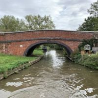
Step 4: Back over the river and up past Bestmoor
Just before bridge 196, leave the towpath on the left, walk up to the road and turn left. The road has no pavement. It passes two Second World War pillboxes, crosses two bridges and then a third with North Aston Mill on the left, and climbs round a bend where traffic comes down the hill.
Past Mill Cottage, at a gate and metal signpost marked Cherwell Valley Walk, turn right through the bridle gate. Go right along the field edge and left round the corner towards the trees, then follow the grass path uphill with the hedge on your right, through three gates. Bestmoor, a Site of Special Scientific Interest, is on your right; the guide warns of an electric fence on the left in one field.
Through the third gate, keep close to the hedge on your right. Look for a grassy path going left and a gate set back to the right: go through it and head left through the trees on a permissive path. Follow the hedge on your left, where there may be sheep, through a gateway that may carry electric fencing, to a large metal gate at the end of the field, opened by undoing a screw. Screw it shut again behind you.
-
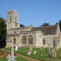
Step 5: North Aston church and the green
Follow a short farm track, long grass in summer and muddy when wet, and turn left on the farm road. Walk up the hill, with no pavement, and turn right to the main road. Turn left and walk downhill on the road, again without a pavement, to the gatehouse on your right.
Go up the drive by the gatehouse, St Mary's Walk, keeping off the grass. Pass the drive to North Aston Manor on the right, go through the pedestrian gate on the left and keep to the main track past the buildings to St Mary the Virgin. Follow the roadway left towards North Aston Hall and on to the Somerton road, and turn left back to the green.
The walk in detail
North Aston, the Causeway and Somerton Mill is a 5.2-mile (8.4km) circular walk from North Aston Green, about three hours with 80m of climbing. It crosses the Cherwell meadows on an old causeway by Somerton Mill, follows the Oxford Canal north to Somerton's bridge and climbs back past Bestmoor's hay meadows and North Aston's church and hall.
It is Cherwell District Council's Cherwell Valley North Circular, the northern loop of the waymarked Cherwell Valley Walk. Nobody from this guide has walked it yet: the directions come from the council's guide, last updated in February 2025, its older leaflet and the line we drew on OpenStreetMap's paths. Expect mud whatever the season, and do not set out after heavy rain.
Grange Farm and the lost village of Nethercote
The first 1.3km are on the narrow lane south from North Aston, with views of the valley through the trees. The bridleway at the crossroads takes you down to Grange Farm, which the council's leaflet says is what remains of Nethercote, a village recorded in Domesday Book and probably deserted late in the fifteenth century, when its land was let for grazing. The banks and hollows of the old village are still in Sheep Field beside the farm.
The Causeway to Somerton Mill
Beyond the farm a bridle gate opens onto the Causeway, the reason to come. The council says it was built just wide enough for horses and carts to cross the wet Cherwell meadows to Somerton Mill, and that tanks did it considerable damage in the Second World War. It is still narrow, rutted and overhung with branches, and after rain the meadow beyond it floods: the guide's own instruction is to turn back if it is too wet.
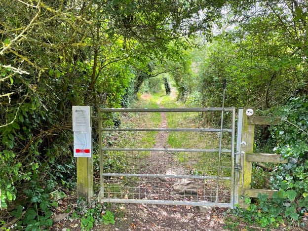
The Oxford Canal and Somerton's bridge
The towpath from bridge 199 to bridge 196 is about 1.8km of grass, narrow in places and eroded at the edges. The Oxford Canal opened here in 1790, the council's leaflet says, one of the earliest in England and the first to join the industrial Midlands to London; it carried goods until the 1950s and now carries holiday boats. Somerton's church stands on the hill across the water as you near the road bridge.
The council's older leaflet points walkers a short way past bridge 196 to four sculptures by Michael Fairfax, carved from old lock timbers with Jamie McKendrick's poem Lock; we have not confirmed they are still in place. On the road back over the river, look for the two pillboxes, part of the Second World War defences along this valley.
Bestmoor and North Aston
The climb home runs beside Bestmoor, a Site of Special Scientific Interest. Natural England's citation says it was once Somerton's hay lot meadow and holds one of the largest known British populations of narrow-leaved water dropwort, estimated at over 30,000 plants, and that teal, wigeon, lapwing and golden plover feed in this part of the valley in winter. The council's guide calls the plant rare and adds curlews and reed buntings. The council's own walkers saw a red kite on this stretch.
The last stretch is the drive called St Mary's Walk, through North Aston's parkland past the church of St Mary the Virgin and North Aston Hall. The council says the church and hall are the village's earliest buildings, and that the medieval village stood around them until it was abandoned in the fifteenth century. Back on the Somerton road, the drinking fountain by the green was built in 1863 and restored for the millennium in 1999.

The Banburyshire newsletter
Events, new places and the best of the season, about once a month. Unsubscribe at any time.
What walkers should know before setting out
Flooding is the main thing, as of the council's last check in February 2025, when it found the route muddy but not flooded. The meadow beyond the Causeway is often under water after wet weather, and the towpath north of bridge 199 floods in winter. The council's guide tags the route hilly and steep, though the only real climbs are the lane past Mill Cottage and the field path beside Bestmoor.
Livestock are likely in several fields, including cows by the canal, and the guide warns of electric fencing on the way back. The gates are farm gates, one tricky to open and one closed with a screw. About 2km is on narrow lanes and roads with no pavement, at the start, past North Aston Mill and on the farm road near the end. One stretch, through the trees above Bestmoor, is a permissive path, not a right of way.
Getting there and parking
There is no car park in North Aston: the council asks walkers to park considerately by the green. Stagecoach's S4 between Banbury and Oxford stops at North Aston Turn on the A4260, about 600m west of the green, roughly hourly from Monday to Saturday (November 2026); our Steeple Aston guide gives about every 90 minutes on Sundays. By train, Heyford station is about 4.3km (2.7 miles) south of bridge 199 along the towpath, which makes a long day of it with the Heyfords Circular.
There is no pub on the route. The Chequers, the old Red Lion in Steeple Aston, the next village south, reopened in July 2026. Its own site says it is closed on Tuesdays and opens only in the evening on Mondays; ring 01869 389174 before you go.
Other walks nearby
The Heyfords Circular is the gentler loop downstream, from Heyford station along the same canal. The council's walk to Rousham's Eyecatcher, the folly William Kent built for the view from Rousham, is the council's next loop south, from Heyford station through Steeple Aston; it is held for now because of flooding. Our Heyfords guide covers the villages at the south end of the towpath. For more towpath, the Oxford Canal from Banbury to Cropredy is the stretch further north, and Souldern is the village above the canal beyond Somerton.
Places on the way
-
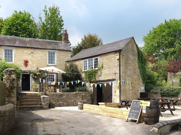
The Chequers, Steeple Aston
Pubs
The former Red Lion at Steeple Aston, reopened in July 2026 under its original name of The Chequers: a Hook Norton pub established in 1765, with seasonal British food, a terrace and Sunday roasts.
Verified Nov 2026
Stay near the start
Inns, cottages and hotels within a short drive of where the walk begins, so you can set off early.
Where to stay in Steeple Aston-
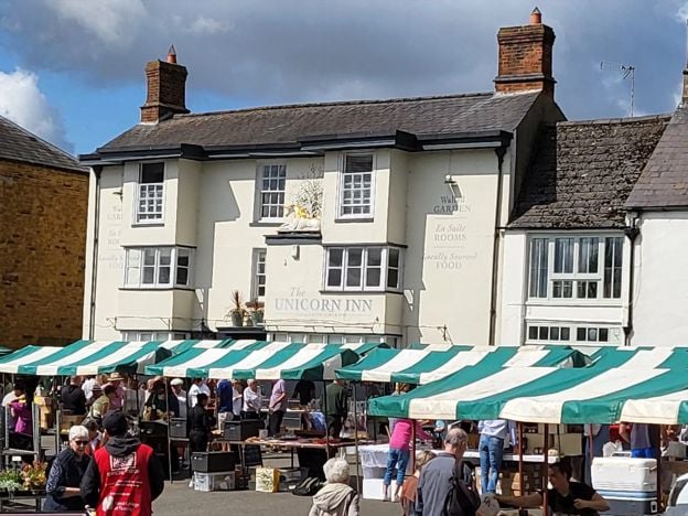
The Unicorn Inn, Deddington
Pubs · Deddington
A Grade II listed inn of the mid 17th century on Deddington Market Place, with open fires, a garden behind, British classics and seven rooms, four of which take dogs.
Dog-friendly · Family-friendly
Verified Nov 2026
-
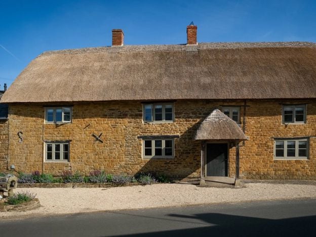
The Duke of Cumberland's Head, Clifton
Restaurants
A thatched, marlstone village pub at Clifton near Deddington, reopened under a new owner with a head chef from The Five Fields and Core, a menu that changes daily and three rooms.
Verified Nov 2026
-
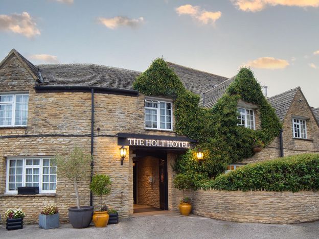
The Holt Hotel, Steeple Aston
Hotel · Steeple Aston
An independent 87-room hotel in an old coaching inn at the Hopcrofts Holt crossroads on the A4260 near Steeple Aston, with a bar, restaurant, afternoon teas and a Sunday carvery, about 15 minutes' drive from Bicester Village.
Family-friendly · Wedding venues · EV charging
Verified Nov 2026
More like this
Stories on this walk
-
Villages between Banbury and Bicester
Story · Guides · 8 minute read
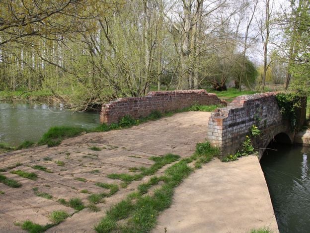
The villages between Banbury and Bicester, group by group: the Cherwell valley from Somerton to Kirtlington, the plateau villages of Souldern, Fritwell and Middleton Stoney, and the quiet country north-east of Bicester. Which are worth a stop, what each has, which have no pub.
More walks to try
-
Heyfords Circular from Heyford Station
Walk · Starts in Upper and Lower Heyford · 2 hrs · Circular
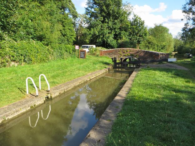
The Heyfords Circular is a 3.4-mile (5.5km) easy circular walk from Heyford station, about two hours. It follows the Oxford Canal north to Allen's Lock, climbs to Upper Heyford's church and returns over fields to Lower Heyford's square. Flat, with gates, livestock and mud.
-
Adderbury and Bloxham Grove
Walk · Starts in Adderbury · 1 hr, 30 mins · Circular
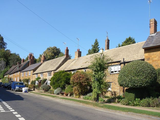
A 3.1-mile (5.1km) circular walk from the Methodist church in East Adderbury, about an hour and a half of easy walking with stiles. Field paths lead to Bloxham Grove and its small windmill, down to Lower Grove Mill on the Sor Brook, and back to The Green.
-
Kings Sutton Railway Walk from the Station
Walk · Starts in Kings Sutton · 2 hrs · Circular
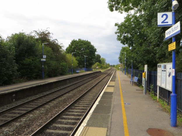
A 4.4-mile (7.1km) circular walk from Kings Sutton station on the parish's own Railway route, easy to moderate and about two hours. It climbs through the village past the spire, crosses fields north, and returns over the railway line on foot by the old Bog Spring.