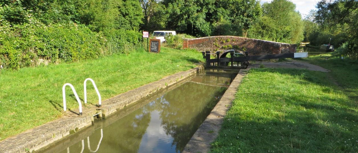
Philip Jeffrey, CC BY-SA 2.0, via Wikimedia Commons
Heyfords Circular from Heyford Station
The Heyfords Circular is a 3.4-mile (5.5km) easy circular walk from Heyford station, about two hours. It follows the Oxford Canal north to Allen's Lock, climbs to Upper Heyford's church and returns over fields to Lower Heyford's square. Flat, with gates, livestock and mud.
- Distance
- 5.5 km (3.4 mi)
- Difficulty
- Easy
- Time
- 2 hrs
- Ascent
- 21 m
- Circular
- Circular
The route
Starts at Heyford station, Lower Heyford (OX25 5PD) Muddy in winterLivestock in fieldsRoad walking Download GPX
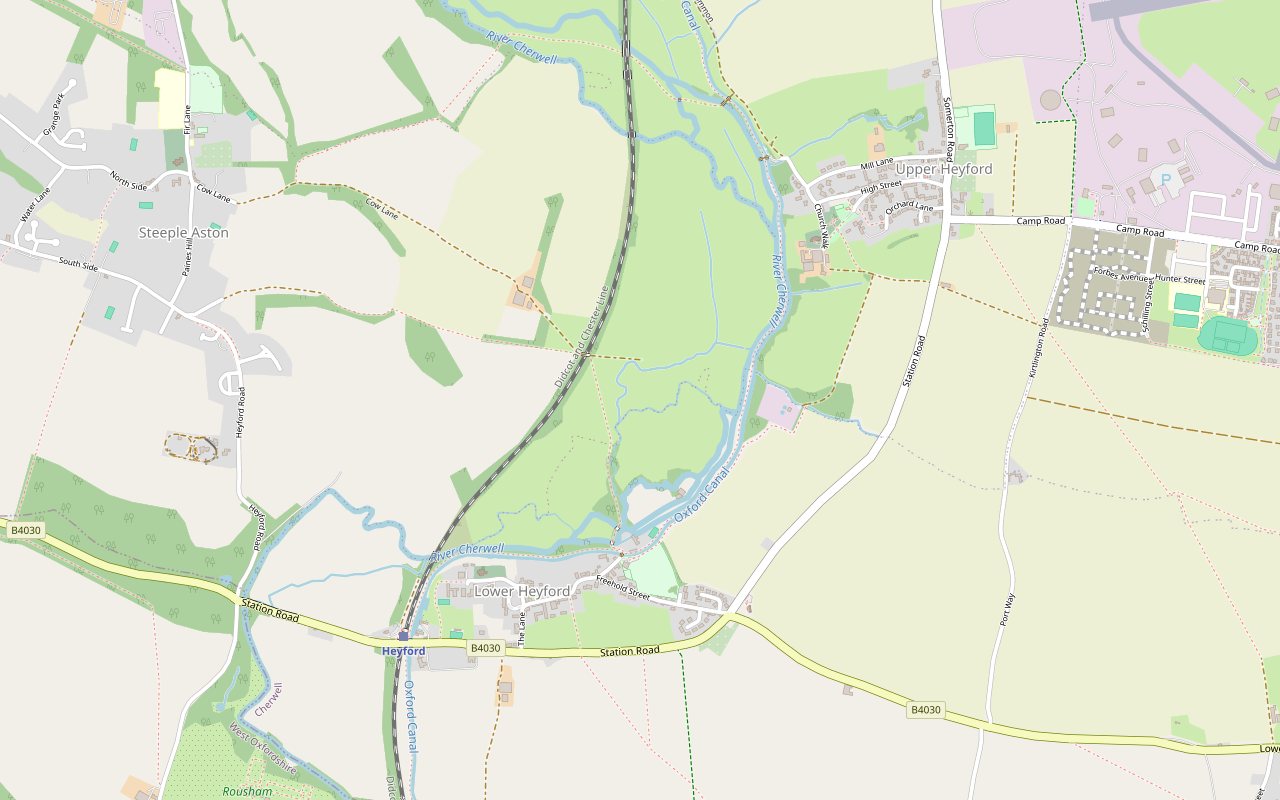
Step by step
-
Step 1: Heyford station to Allen's Lock
From the station car park, cross the railway by the footbridge. Leave the platform through the gap in the stone wall on the left and turn left onto the Oxford Canal towpath. Do not cross the canal bridge or go under it.
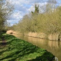
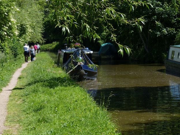
Follow the towpath north for about 2.2km. You pass the boatyard at Heyford Wharf across the water, then the Mill Lift Bridge, which you leave for the way home. Mill House stands on your left, and the River Cherwell runs beside you through the trees. The council's guide warns that the towpath is narrow and badly eroded in places, with low branches, though the Canal & River Trust improved one stretch in 2023.
Upper Heyford's church and a group of large farm buildings come into view on the right. At Allen's Lock, turn right over the brick bridge, number 204.
- Muddy in winter
-
Step 2: Allen's Lock to Upper Heyford church
Follow the track up from the bridge to the road, Allens Lane, and keep straight on along it and then along Church Walk, with the cemetery on your left and St Mary's church on your right.
To see the village, turn left instead up the High Street, past honey coloured stone houses, one of them dated 1722 in the council's guide, then right at the top, right down Orchard Lane and along the path called the Tchure to the green by the Reading Room. The council's guide takes this way; our line takes the shorter Church Walk, which both guides offer, and the High Street loop adds about 1km.
Opposite the church, turn left and then right at the footpath sign, as the council's guide directs for this shorter way.
-
Step 3: Fields back to Lower Heyford
Go through the gate into the field below the church: the guide says livestock are often in it. Head across towards a single tree, where the ground is uneven, pass to the left of it and make for the gate on the far side, taking care over a broad ditch. Through the gate, turn left, then right through the next gate, and follow the track and then a concrete track down to the water treatment works.
Just before the works gates, turn left along the field edge, right at the corner of the works and then left again. Follow the field edges south through several fields, with the canal parallel on your right beyond the hedges. The path crosses from Upper Heyford parish into Lower Heyford at the works.
Carry on along the edge of the village playing fields, bear right through a concreted area past the Lower Heyford Sports and Social Club, and walk on to Mill Lane.
- Muddy in winter
-
Step 4: Lower Heyford's streets and back to the station
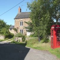
Turn left on Mill Lane, away from the lift bridge, and right into Freehold Street. Walk on the left side of the road around the second of its blind bends, as the guide advises. Look for White Horse Cottage, once an inn, and the listed red telephone kiosk on the corner.
Turn right into Market Square past the side of the Bell. To avoid the kissing gates ahead, go left along The Lane instead and right at the main road to the station. Otherwise cross the square, bear right past the manor house of 1669 and St Mary's church, and go through the gateway at the end of the lane and a second gateway beyond it, back to the canal.
Turn left, keep close to the fence and head for the corner of a stone wall. Follow the wall to a kissing gate and turn right on Station Road, past Heyford Wharf. Cross the canal bridge on the path to the right, then turn right and left through the wall back to the station.
The walk in detail
The Heyfords Circular is a 3.4-mile (5.5km) circular walk from Heyford station in Lower Heyford. It follows the Oxford Canal north to Allen's Lock, crosses to Upper Heyford's church and comes back over fields to Lower Heyford's market square. It takes about two hours and is almost flat, through a valley that the council's guide says is largely a Conservation Target Area for wildlife.
Cherwell District Council publishes the route as its Cherwell Valley Heyfords Walk, and its older leaflet credits Lower Heyford Parish Council with devising it. Nobody from this guide has walked it yet. The directions come from the council's guide, its leaflet and the line we drew on OpenStreetMap's paths, and we will check them on foot.
The Oxford Canal from Heyford to Allen's Lock
The first half is towpath, about 2.2km of it. The council's leaflets say this southern section of the Oxford Canal opened in 1790 and that the wharf at Lower Heyford was an original feature; the tall red brick house behind the boatyard sheds is an early nineteenth-century canal house. The railway beside it came in 1850, and Heyford was one of the line's three original intermediate stations.
The Cherwell runs parallel through the trees on your left. Mill House, on the far side, is late eighteenth or early nineteenth century, probably on the site of the mill for which the course of the river was moved in the mid sixteenth century. Much of the valley is a Conservation Target Area, and in spring and summer the council's guide points out butterflies, bees and dragonflies along the bank. At times of flood, its older leaflet says, the flood meadows can look like a lake.
Upper Heyford and its church
Allen's Lock is where you leave the water and climb the short way into Upper Heyford. William of Wykeham bought the manor in 1380 for New College, Oxford, and the college's arms are on the buttresses of the tower of St Mary's, the only medieval part left when the church was rebuilt in 1865 to 1867. The early fifteenth-century barn built for the college, listed Grade I, stands on private farmland near Manor Farm, and we found no public access to it.
The plateau above the village is the former RAF Upper Heyford, now Heyford Park. You cannot see much of it from this walk, but the airbase's story is worth reading before you come, and the heritage centre runs booked tours of the Cold War airbase on most Sundays from March to November.
Lower Heyford's square
The way home runs down Freehold Street, where the council's leaflet picks out White Horse Cottage, a seventeenth-century house that was once an inn, a listed red telephone kiosk, and Paine's Cottage, Forge House, Town House and College Farm House. A corn market was started in Market Square in 1845, but the Victoria County History says regular markets had stopped by 1887. The Bell on its corner is a late seventeenth or early eighteenth-century house with a tall narrow window at the back, but the pub closed in April 2025, and we found no news of it reopening.
Past the square, the manor house was rebuilt in 1669 and keeps a datestone, and St Mary's church beside it, first dedicated in the mid eleventh century, is listed Grade II*. Our Heyfords guide has more on both villages, Heyford Bridge and Rousham across the river.

The Banburyshire newsletter
Events, new places and the best of the season, about once a month. Unsubscribe at any time.
What walkers should know before setting out
The length first. The council's guide gives 4.9km and its older leaflet 3.5km, but the towpath alone is 2.2km, and our line through the same places measures 5.5km. Plan on 3.4 miles. Taking the guide's loop up the High Street adds about 1km.
The towpath is narrow and badly eroded in places, the council's guide says (August 2024), with low branches, though the Canal & River Trust improved one stretch in 2023. The field below Upper Heyford church often has livestock in it, the ground is uneven and there is a broad ditch at the far gate. The older leaflet mentions stiles near the water treatment works; the 2024 guide describes only gates and kissing gates there, so expect either until we have walked it. Freehold Street has a double blind bend, and the guide asks walkers to keep to the left side of the road round the second.
The valley floods. The council's leaflet says sections of the valley bottom tend to flood in winter and asks walkers to turn back if conditions are too wet. Its longer walk to Rousham's Eyecatcher from the same station carried a notice in October 2024 that flooding had made it impassable at one point, and suggested this loop instead, which stays on the towpath and the fields on the east side of the canal.
Getting there, parking and food
Come by train if you can: Great Western Railway trains between Banbury and Oxford call at Heyford, and the walk starts on the platform. The station car park has 28 spaces, and we found no other public car park in Lower Heyford. Thames Travel's 25 and 25A from Bicester run through Heyford Park to Upper Heyford, which is on the route, Monday to Saturday, but not to Lower Heyford or the station; Stagecoach runs the 25A on Sundays.
For food, Kizzies at Heyford Wharf, beside the station, is the nearest stop. Oxfordshire Narrowboats, whose wharf it is on, says it opens from 9am to 5pm daily, but an older notice on the same page says it is closed, so check before you rely on it (November 2026). The Barley Mow in Upper Heyford is a short way off the High Street loop, but we found no website for it, so ring before you rely on it.
Other walks nearby
North Aston and Somerton Mill is the council's next loop up the valley, crossing the Cherwell on an old causeway and coming back along the same canal. The Oxford Canal from Banbury to Cropredy is the towpath further north. Across the river, Rousham's garden is a short walk over Heyford Bridge, and Steeple Aston is the next village south-west.
Stay near the start
Inns, cottages and hotels within a short drive of where the walk begins, so you can set off early.
Where to stay in Upper and Lower Heyford-
Oxfordshire Narrowboats, Lower Heyford
Self-catering · Upper and Lower Heyford
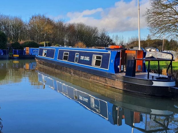
Self-drive narrowboat holidays, short breaks and day boats from Heyford Wharf on the Oxford Canal at Lower Heyford, from mid March to the end of October, for 2 to 12 people, dogs included.
Dog-friendly · Family-friendly
Verified Nov 2026
-
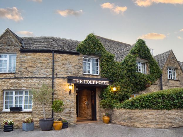
The Holt Hotel, Steeple Aston
Hotel · Steeple Aston
An independent 87-room hotel in an old coaching inn at the Hopcrofts Holt crossroads on the A4260 near Steeple Aston, with a bar, restaurant, afternoon teas and a Sunday carvery, about 15 minutes' drive from Bicester Village.
Family-friendly · Wedding venues · EV charging
Verified Nov 2026
-
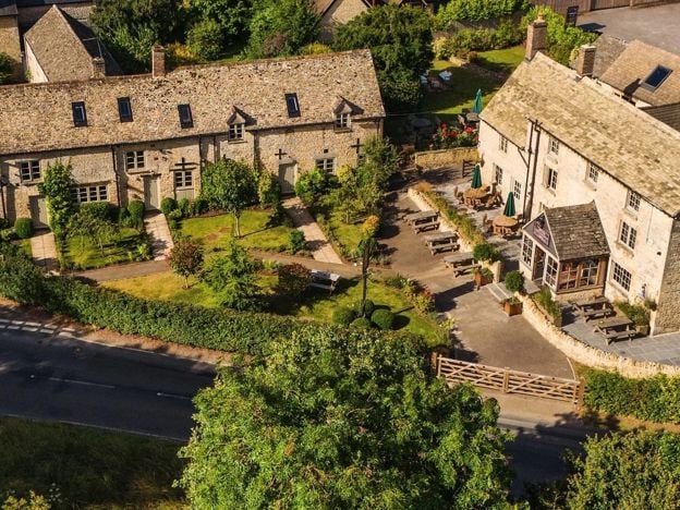
The Killingworth Castle, Wootton
Restaurants
A serious dining pub with eight rooms at Wootton near Woodstock, with 3 AA Rosettes and a Michelin Guide recommendation for 2026, à la carte and tasting menus, and open from Wednesday to Sunday.
Dog-friendly · EV charging
Verified Nov 2026
More like this
Stories on this walk
-
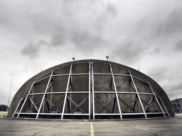
Heyford Park: what became of RAF Upper Heyford
Story · History · 8 minute read
The Americans left RAF Upper Heyford in 1994 with no plan for what came next. Fifteen years of argument produced a protected Cold War landscape, a business park in the hangars and Heyford Park, a village of more than a thousand new homes, with 9,000 more now proposed.
More walks to try
-
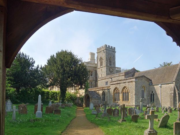
North Aston, the Causeway and Somerton Mill
Walk · Starts in Steeple Aston · 3 hrs · Circular
A 5.2-mile (8.4km) moderate circular walk from North Aston Green, about three hours. It crosses the Cherwell meadows on an old causeway by Somerton Mill, follows the Oxford Canal north and climbs home past Bestmoor and North Aston church. It floods after rain.
-
Oxfordshire Way: Kirtlington to Weston-on-the-Green
Walk · Starts in Kirtlington · 1 hr, 20 mins
A 3.3-mile (5.3km) easy one-way walk on the Oxfordshire Way from Kirtlington to Weston-on-the-Green, about 80 minutes. It crosses Kirtlington Park and open fields, with gates and three stiles, and the 24 bus links both ends, Monday to Saturday.
-
Bicester West Health Route and Bure Park
Walk · Starts in Bicester · 1 hr, 10 mins · Circular · Dog-friendly
The Bicester West Health Route is a 5K (3.1-mile) easy circular walk on a painted blue line through Bure Park and west Bicester, about 70 minutes. It is a town loop on pavements and paths, ending through a railway tunnel in Bure Park Nature Reserve.